Monthly Archives: December 2017

Forecast for Tuesday, December 26, 2017

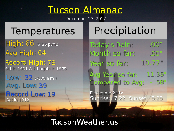
75 on Christmas Day much to the delight or chagrin of us all. (your individual mileage may vary) The warmth continues until further notice, but there is one interesting feature that could bring us a little moisture. A low currently west of the tip of Baja will bring us some high clouds, thick at times, later today. As the low gets closer to northern Mexico we’ll see a few high clouds from time to time later in the week. Could it bring us some moisture and a chance for rain? Maybe, but right now the betting money is on nope. Of course we’ll keep you posted as we go.

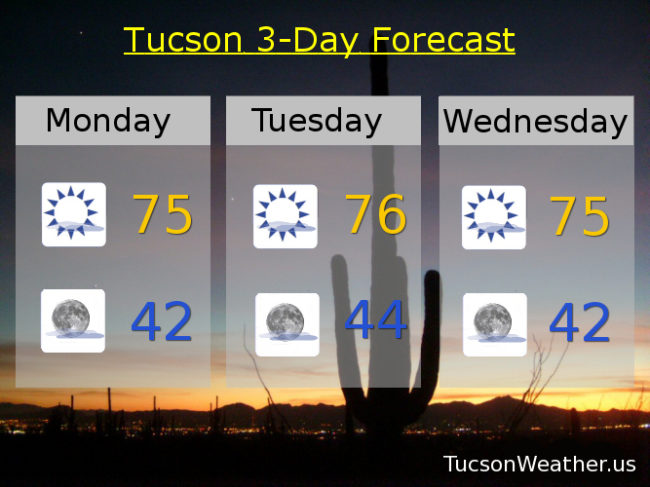
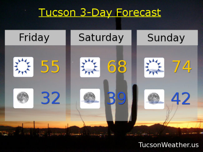
Increasing high clouds today with a high near 74.

Mostly cloudy tonight with a low in the low 40s.

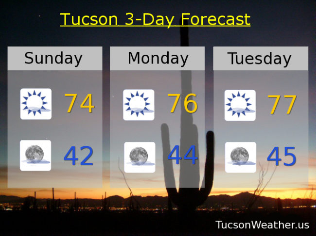
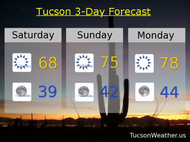
Mostly sunny tomorrow with a high in the mid 70s. Sunny upper 70s Thursday, Friday and Saturday. Mostly sunny low 70s Sunday and New Year’s Day.

Forecast for Sunday, December 24, 2017

‘Twas the night before Christmas and all through the house, not a raindrop was falling not even snow in Taos. The stockings were hung by the chimney with care, in hopes that the forecast would change either here or there. High clouds for possible sunrise and sunset enhancement, warm temperatures too running rampant. Sugar plums dancing in my head, with lows in the 40s when I get out of bed. And what to my wandering eyes should appear? A slight chance of rain by next weekend but south of here. I suppose I should exclaim as I wrap up this rhyme, Merry Christmas to all! and have a great time!

Forecast for Saturday, December 23, 2017

Our warming trend is fixin’ to commence (which is redundantly repetitive, but you get the idea). High pressure nosing back into our business with a few high clouds from time to time for possible sunrise and sunset enhancement. Upper 60s this afternoon. Mid 70s tomorrow. Upper 70s for Christmas. Mid 70s Tuesday, Wednesday, Thursday and Friday. Lows in the upper 30s tomorrow morning then in the low to mid 40s. Enjoy!

Forecast for Friday, December 22, 2017

HARD FREEZE WARNING until 9:00 this morning. It is freezing hard out there right now. My plants are inside the living room enjoying the day. We might watch some football together later. They get to stay in one more night since it’s supposed to dip near freezing again tonight after a cool high of just 55ish. Then it’s a fast warming trend through Christmas into next week. 68 tomorrow. 74 Christmas Eve Day. 76 Christmas Day will be the warmest Christmas since 2005 if it all comes true. Sigh. I guess it will be a tank top Christmas after all. Mid 70s Tuesday too. Then we start to cool off as a new storm approacheth. However it looks like we will stay dry. Hopefully that will change as we get closer. Stay tuned! Low 70s Wednesday. Upper 60s Thursday.