March came in like a lamb and sure enough it is going out like a lion. I mean it could be worse, but kinda like a lion. Relatively speaking. Cold front blowing through this morning with a few light rain showers (half the calories of our regular rain showers) and much cooler. Once the rain clears this morning we should see clearing skies and increasing winds. So much so that the National Weather Service has issued a RED FLAG WARNING for this afternoon and evening. If you smoke, please for the love of all that is right and good, keep your butts in the car! Also be careful if you are planning on setting stuff on fire. A little disturbance in the force moves down the backside of the low that is missing us to the north and east. That will give us a slight chance for showers tonight and a slight chance for an isolated thunderstorm tomorrow. Hopefully near you! Then our old pal high pressure returns bringing it’s fair weather friends with him. Warming up into next week. Enjoy!
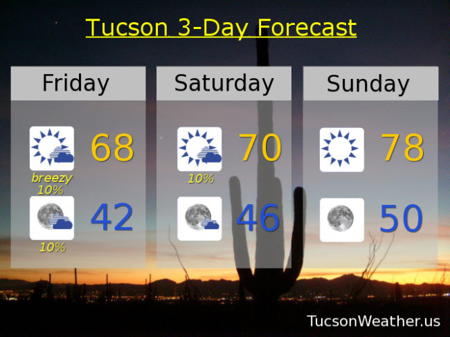
A chance for some light showers this morning becoming sunny this afternoon with west winds 10-20 mph and gusty. Today’s high in the upper 60s.
Partly cloudy tonight with a slight chance for showers after midnight and a low near 42.
Mostly sunny tomorrow with a slight chance for isolated thunderstorms and a high near 70.
Sunny Sunday 78. Low 80s Monday and Tuesday. Mid 80s Wednesday. Near 90 Thursday.