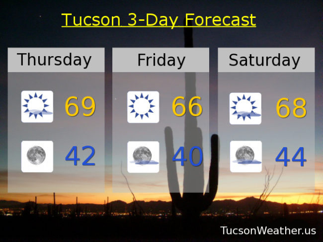
“Things” are getting interesting! The computer models aren’t in complete agreement yet, but it looks like we may (may) see some rain perhaps on Sunday. First things first. A system diving out of the northern Rockies will be missing us to the north and east on its way to the Four Corners and into New Mexico. A few more clouds today as a result and cooler temperatures in the upper 60s to near 70. Cooler tomorrow with sunshine mid 60s. More clouds as our next system or systems approacheth Saturday with a high in the upper 60s. Here’s where it gets complicated and the models don’t yet agree. We will see another system moving in from the NW that will bring us cooler air. What isn’t certain is if a low off the Baja Coast will get involved. IF it moves our way and gets pulled into the first system it may bring the moisture we need for some showers on Sunday. Right now the National Weather Service has introduced slight chances into the official forecast. It could be more or none at all. We’ll all just have to stay tuned!
Slight chance for showers Sunday low 60s. Sunny Monday mid 60s. Near 70 Tuesday. Low 70s Wednesday.
Will there be another system by the end of next week? Stay tuned some more again!