Another down day for storms yesterday although some mountain locations got wet. High pressure will remain in the vicinity of northern New Mexico to the Texas panhandle into next week which should continue to increase our moisture from the south and southeast. That means the return of scattered storms as early as late this afternoon into tonight and continuing into next week. As the moisture increases we’ll see the threat of locally heavy rain come back into the picture. If today’s forecast high comes true it will be the first 100 degree day since July 15th. If we don’t make it, like we didn’t yesterday, then our “cool” streak will continue! Our average high for this time of year is 98. Viva Monsoon 2017!
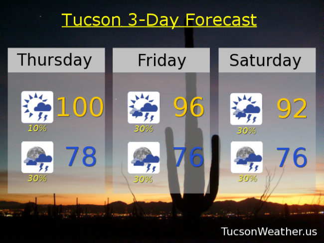
Mostly sunny today with a slight chance of a storm near you and a high near 100.
Scattered storms possible tonight with a low near 78.
Scattered afternoon and evening storms continue into next week with highs in the mid to low 90s. Upper 90s Tuesday and Wednesday.