Happy Friday Eve! Makes the weekend seem closer. Which is good because we are gonna have to put up with a bit of wind nonsense between now and then. Fire danger is high so the National Weather Service has issued a RED FLAG WARNING for this afternoon and evening and ditto for tomorrow. Please for the love of everything that is right and good if you smoke keep your butt in the car. Also be careful if you like to set stuff on fire. Maybe resist the urge for a couple of days. Calming down and warming back up for the Memorial Day Weekend! Then a surge (OK, surge is too strong) of moisture moves our way and we have a slight chance of a thunderstorm or two! More thunder than storm so another chance at fires. Stay tuned and stay not on fire!
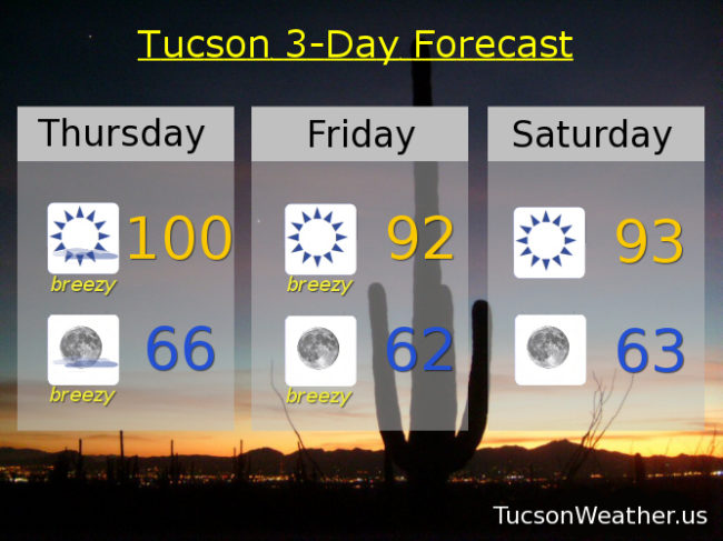
Mostly sunny and breezy today with SW winds 15-25 mph gusting over 30 and a high near a hunderd.
Mostly clear skies tonight with breezes dying down overnight for the most part and low in the mid 60s.
Sunny and breezy tomorrow with a SW winds 15-25 mph gusting to around 35 and a high in the low 90s. Sunny low 90s Saturday. Upper 90s Sunday. Near 101 Memorial Day. Slight chance for a storm Tuesday near 99. Mostly sunny Wednesday upper 90s.