Appropriate for a Twofer Tuesday as we dibble dip with an advisory AND warning. A WIND ADVISORY in effect from 11:00 this morning until 8:00 tonight so be advised, it’s going to be windy. Also a RED FLAG WARNING in effect from 2:00 this afternoon until 8:00 this evening. Not good news for the Sawmill Fire that is still burning to our south. Let’s hope nothing else gets started! A storm missing us to the north today is driving the winds up and the temperatures back down to average for this time of year. A break between storms tomorrow with even more wind Friday and Saturday. Looks like we are staying dry, but high clouds from time to time for possible sunrise and sunset enhancement. Stay tuned!
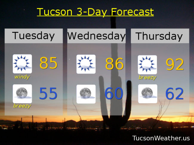
Mostly sunny and windy today with west winds 20-30 mph this afternoon gusting to around 40 and a high near 85.
Mostly clear tonight with west northwest winds 20-30 mph gusting to 40 becoming southerly and relaxing to 5-15 mph overnight with a low near 55.
Mostly sunny tomorrow with northwest breezes 5-15 mph a high in the mid 80s.
Sunny Thursday with west winds 10-20 mph and gusty with a high in the low 90s. Patchy blowing dust possible Friday with a high near 90. Mostly sunny and breezy Saturday near 80. Sunny Sunday low 80s. Upper 80s Monday.