Back to the salt mines for most of us. I have lots of watermelon left over from yesterday, so there’s that! More moisture and more clouds today as a weak low combined with an increase in moisture will give us a chance for storms south and east of Tucson. If those storms form close enough to us we may see some gusty outflow winds move through the metro later this afternoon/evening. It may not happen, but something to watch. More clouds as a result as well which will likely lead to sunset enhancement tonight. A little cooler the next couple of days behind the low. As you can imagine we will warm up by the first weekend of June, because, June! Back to the triple digits. Enjoy!
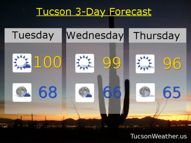
Mostly sunny today with a high near 100. SW winds 10-15 mph. Winds up to 40 mph IF thunderstorm outflow winds reach us by this evening.
Partly cloudy tonight with a low in the upper 60s.
Mostly sunny tomorrow upper 90s. Mid 90s Thursday. Upper 90s Friday and Saturday. Near 101 Sunday and Monday.