High pressure hanging out one more day before it weakens and heads south and east. 104 is the record set in 1983 & hit again in 1984 and 2001. Will we add 2017 to the list? If the forecast comes exactly true we will. I’ll let you know how it goes tonight. Then it’s more wind and a FIRE WEATHER WATCH for tomorrow and Friday, so watch out for fires. High pressure begins its return this weekend but with some high cloudiness for possible sunrise and sunset enhancement. Enjoy!
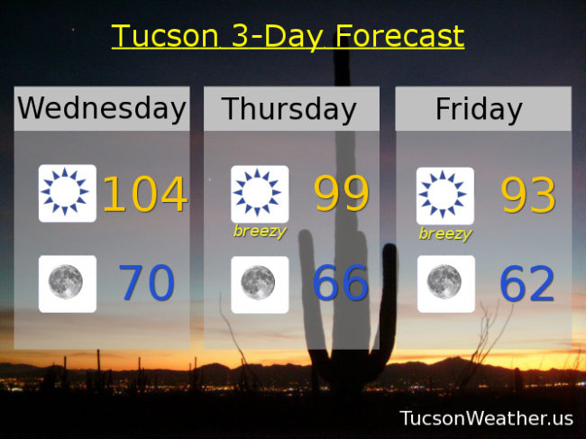
Sunny and hot today with a high near the record of 104.
Clear skies tonight with a low near 70.
Breezy tomorrow with SW winds 15-25 mph gusting over 30 and a high near 99.
Breezy Friday with SW winds 15-25 mph gusting to near 35 and a high near 93. Sunny Saturday low 90s. Mid 90s Sunday. Upper 90s Monday and Tuesday.