Tag Archives: Excessive Heat Warning

Forecast for Friday, June 5, 2020

It’s Friiidaaay!!!

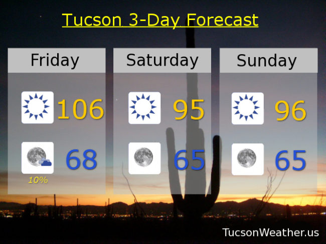
Only 108 yesterday. I mean compared to the record of 112 I’d say we done good. EXCESSIVE HEAT WARNING for one more day, so be warned, the heat will be excessive. Brezzy fo Sneezy today too with WSW winds 10-20 mph gusting to near 30ish. High this afternoon of 106. A 10% chance for a storm or three (hopefully near you) this evening and a low in the upper 60s.

Today’s breezes bringing in cooler air for the weekend. Mid 90s tomorrow and Sunday!

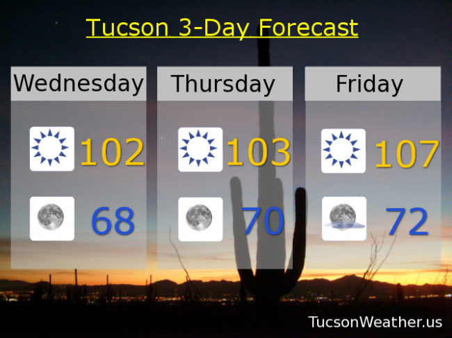
Mid 90s Monday and Tuesday as well. Heating back up mid week. 102 Wednesday. 106 Thursday. Be Cool

Forecast for Thursday, June 4, 2020

It’s Friday Eve! (makes the weekend seem closer…)

It’s too hot. Too hot baby. Gotta run for shelter, gotta run for shade… EXCESSIVE HEAT WARNING in effect today and tomorrow. Be warned, the heat will be excessive. 107 both days. Ouch. Some breezes kicking up tomorrow. Not quite breezy fo sneezy levels, but out of the SW 10-15 and gusty so there’s that. It’s good news with cooler air on the way! Mid 90s Saturday. Upper 90s Sunday. Mid 90 Monday. Upper 90s Tuesday. 101 Wednesday. Be Cool 😎

Forecast for Wednesday, June 3, 2020

Mike Mike Mike Mike Mike. What day is it Mike? A rather excessive day me thinks..

EXCESSIVE HEAT WARNING today and tomorrow. Be warned. The heat will be excessive. Not that yesterday was much better topping out at 104. The airport did receive .01″ of rain, so there’s that! The rain chances have evaporated. Typical June weather remains for the next few dayz… Let’s take a look, shall we?

Sunny today with a high of 105. A few clouds tonight mid 70s. Sunny 107 tomorrow. Partly sunny and a bit breezy Friday 104. Sunny Saturday and Sunday upper 90s. Mid 90s Monday and Tuesday! Be Cool 😎

Forecast for Tuesday, June 2, 2020

June starting with rain! .04″ Yesterday, but we are still almost an inch below average for the year. Today we transition back to typical early June weather. EXCESSIVE HEAT WARNING Wednesday and Thursday so be warned, the heat will be excessive. Cooling off a bit by Friday with a breezy fo sneezy conditions. (OK OK, kinda windy) Details in 3… 2…

Sunny and hot today with a high of 103. 105 tomorrow. 108 Thursday! (ouch) Breezy and hot Friday 105. Upper 90s Saturday and Sunday. 99 (I’ve been waiting so long) Monday. Be Cool

Forecast for Saturday, May 30, 2020

108 yesterday! The record was 111 so it could have been worser. (the old starving kids in China argument, but it is good to be grateful) A trace of rain at the airport yesterday as well, so there’s that. It just gets better from here! (until it gets worser again) An EXCESSIVE HEAT WARNING is still in effect today and tomorrow, so be warned, the heat will still be excessive. But hey. You survived yesterday! It’s not gonna be as bad as that and improving as we go. Let’s take a look, shall we?

Mostly sunny and hot today with a high of 104 and a 20% chance for afternoon and evening storms! Storms (hopefully near you) ending tonight with a low in the low 70s. 10% chance for a storm maybe tomorrow 104. 20% Monday 102 para tu. 10% Tuesday 101. Sunny Wednesday 103. 99 (I’ve been waiting so long) Thursday and Friday. Be Cool 😎

Forecast for Friday, May 29, 2020

It’s Friiidaaay!!! It’s also hot… but not that hot. Let me explain.

The EXCESSIVE HEAT WARNING continues through Sunday, so yeah, the heat IS excessive. However. Even though today should be the hottest in our string of hot highs expecting to top out at 107, today’s record is 111! (the exclamation point is not another 1 🙂 ) So. It’s all good. Also a 10% chance for a storm this afternoon doubling to a 20% chance this evening!

Low 70s to start the day tomorrow with a high of 104. 104 Sunday with a 10% chance for a storm. 10% Monday 101. 20% Tuesday upper 90s. 10% Wednesday upper 90s. Sunny Thursday upper 90s. Be Cool!

Forecast for Wednesday, May 27, 2020

Mike Mike Mike Mike Mike. What day is it Mike? It’s EXCESSIVE HEAT WARNING Eve. That’s what day it is.

Yep. The watch has become a warning, so be warned, the heat will be excessive. The EXCESSIVE HEAT WARNING starts tomorrow and runs through Sunday! So yeah. Hot. Makes sense I guess. June approacheth…

Sunny today and 102 para tu y tu y tu y tu… Clear skies tonight upper 60s. 103 tomorrow. 107 Friday! 105 Saturday and Sunday. 101 Monday. Upper 90s Tuesday. Be Cool

Forecast for Thursday, May 7, 2020

Don’t look now, but there is another EXCESSIVE HEAT WARNING in effect for today, so be warned, the heat will be excessive. Even so it should be 3 degrees cooler than yesterday! (and three degrees separation from Kevin Bacon (at least)) Don’t despair. Relief is in sight! There is even a slight chance for storms in the Tucson Weather forecast…

Sunny and hot today and breezy fo sheezy. SW winds 10 – 20 mph gusting to near 30 with a high near 103. Mostly clear skies tonight upper 60s. Mostly sunny tomorrow 99. (I’ve been waiting so long) A slight chance (10%) for a storm tomorrow night and Saturday! with a high in the upper 90s. A 20% chance for storms Saturday night and Sunday! mid 90s. Sunny Monday mid 90s. Low 90s Tuesday and Wednesday. Enjoy!

Forecast for Wednesday, May 6, 2020

Mike Mike Mike Mike Mike. What day is it Mike? Why it’s the hottest May 6th evah. That’s what day it is.

An EXCESSIVE HEAT WARNING in effect for today, so be warned, the heat will be excessive. 105 will break the record of 104 set in 1989 if the forecast comes true. It will also be the second earliest first 105 degree day in Tucson Weather history. Lets do this thing! Mostly clear tonight mid 60s.

103 tomorrow. 99 (I’ve been waiting so long) Friday. Upper 90s Saturday. Slight chance of a storm upper 90s Sunday. Mostly sunny mid 90s Monday and Tuesday. Be cool!

Forecast for Tuesday, May 5, 2020

Feliz Cinco de Mayo upon you. Not sure what the temperature is in Margaritaville, but it’s a fair bet that it is quite a bit cooler and more humid. (you know, tropical paradise and all) We are crankin’ up the AC because outside it’s crankin’ up the heat! Be cool…

Sunny today with a high near 101. Mid 60s tonight. EXCESSIVE HEAT WARNING tomorrow so be warned, the heat will be excessive. A new record high of 105 if it comes true. Ouch! 103 Thursday. 99 (I’ve been waiting so long) Friday. Upper 90s Saturday. Slight chance for a storm upper 90s Sunday. Slight chance for a storm Monday mid 90s. Enjoy!