Monthly Archives: April 2018

Forecast for Wednesday, April 25, 2018

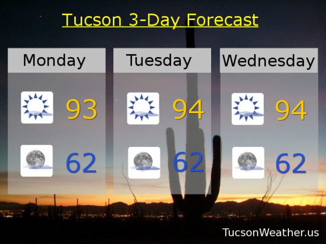
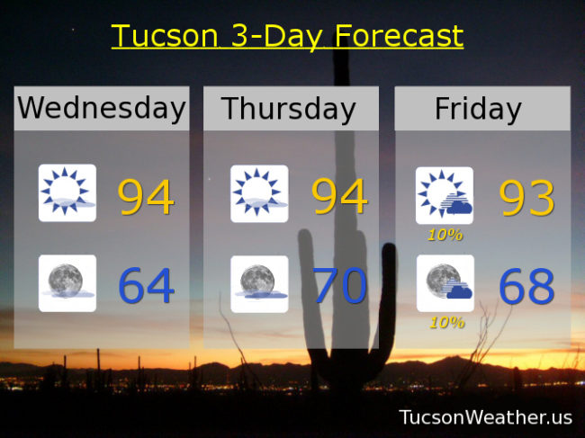
Well. Mostly sunny and warm continues today and tomorrow with highs in the mid 90s and lows in the mid 60s to near 70 respectively.

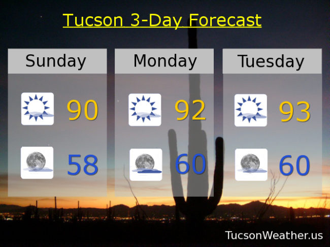
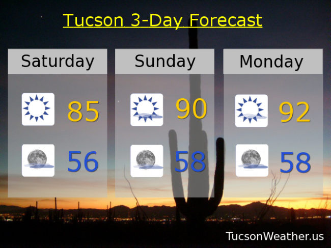
Then. An increase of moisture from the SE will give us a slight chance for isolated thunderstorms Friday afternoon/evening and Saturday afternoon too. The problem with storms this time of year is the lack of moisture in the lower levels of the atmosphere. If we do manage a storm we are likely to see gusty winds near storms and maybe even some dry lightning. So. The rain chances are good and we’ll take ’em. The increased fire danger is also there. Hashtag #justsayin. Low 90s for highs Friday and Saturday.

A pattern change next week cooling us off and bringing back the Spring wind. Sunny Sunday upper 80s. Breezy Monday mid 80s. Low 80s Tuesday. Enjoy!

Forecast for Tuesday, April 24, 2018

I have good news and I have bad news. Let’s start with the bad news since I think that is tradition. Looks like a pattern change will cool us of and bring the winds back early to mid next week. I guess the cooler air is somewhat good news in that bad news so there’s that. The really good news is mainly for areas east of Tucson, but there is a slight chance the Metro might get in on the action. Increased moisture Friday into Saturday will give us a slight chance for a thunderstorm or two! Stay tuned…

Some high cloudiness with our sunshine today, tomorrow and Thursday for possible sunrise and sunset enhancement with highs in the mid 90s. Lows in the mid to upper 60s.

Mostly sunny Friday with a high in the low 90s and a slight chance for an evening storm, hopefully near you. Mostly sunny Saturday with a slight chance for an afternoon and/or evening storm and a high near 90ish. Sunny Sunday upper 80s. Mid 80s Monday.

Forecast for Monday, April 23, 2018

We’ve settled in to mostly sunny skies and warm temperatures through the weekend. High clouds from time to time for possible sunrise and sunset enhancement. Keep your Galaxy S8/S9+ iPhone 7/8/X Pixel Pixel 2 XL handy just in case! Highs in the low to mid 90s and lows in the low 60s. An interesting development toward the end of the week. Increased moisture Friday into Saturday may bring a few thunderstorms, but right now it looks like mainly east of town. Of course we’ll keep you posted. Stay tuned!

Forecast for Sunday, April 22, 2018

I have great news! Wind is not an issue in this forecast issuance. Warming up with high clouds around for possible sunrise and sunset enhancement. A weakening upper low currently over northern Baja California will bring a slight chance for a few sprinkles well to our SE. An increase in moisture well to our east will give the White Mountains a chance for a few thunderstorms next week. Otherwise around these parts we are looking mostly sunny with a few high clouds and warm. Enjoy!

Mostly sunny today near 90ish. Mostly clear tonight upper 50s. Mostly sunny low 90s tomorrow, Tuesday, Wednesday, Thursday and Friday. Near 90 Saturday.

Forecast for Saturday, April 21, 2018

All quiet on the western and SE Arizona front. A very pleasant, albeit kinda warm weekend is in store! Yesterday’s high was an outstanding 74 degrees. Today we jump 11 to 85 if this forecast comes exactly true. That is really close to our average high this time of year of 84.

Somewhat interesting developments in Baja California. A weakening low will bring us increasing clouds tonight and into tomorrow. Not expecting any rain in the metro, but perhaps a few hundredths to our east. Very light if it happens. I’m hoping we’ll have some sunrise and sunset enhancement! Tonight’s low in the mid 50s and tomorrow’s high near 90.

Mostly sunny Monday low 90s. Mid 90s Tuesday. Low 90s Wednesday and Thursday. Friday could get interesting as one model is trying to give us a chance for thunderstorms as far west as Tucson, while the others keep the chances east. For now we’ll go sunny Friday near 90. We’ll keep you posted. Stay tuned!