Category Archives: Daily Forecast

Forecast for Monday, November 6, 2017

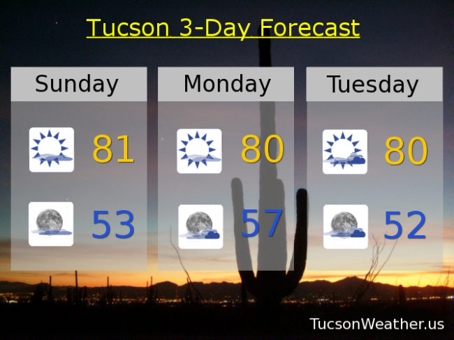
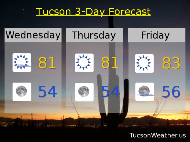
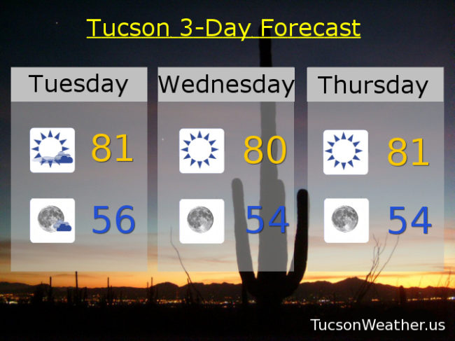
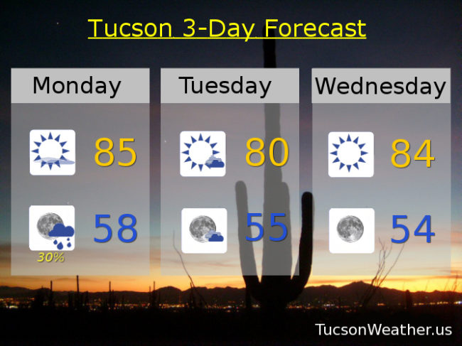
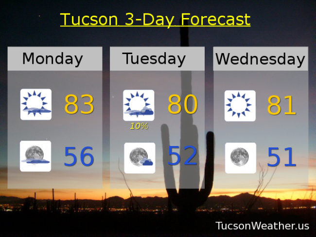
Yesterday we topped out at 81 and while that is a few degrees above average for this time of year, it was actually downright pleasant IMHO. We’ll be a degree or two warmer today with considerable high cloudiness streaming in ahead of a disturbance in the force that will actually give us a slight chance for light rain showers tomorrow! (that was a long sentence) Once the system moves out it’s back to mostly sunshine and low 80s for highs and low 50s for lows. Enjoy!

Partly sunny today with a high near 83ish.

Mostly cloudy tonight with a low in the mid 50s.

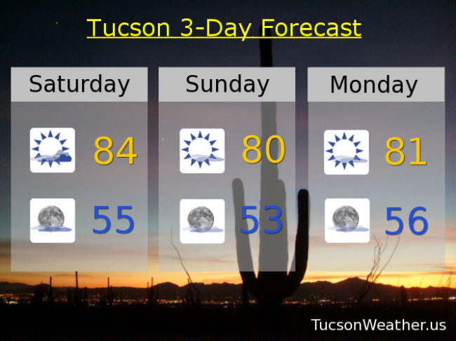
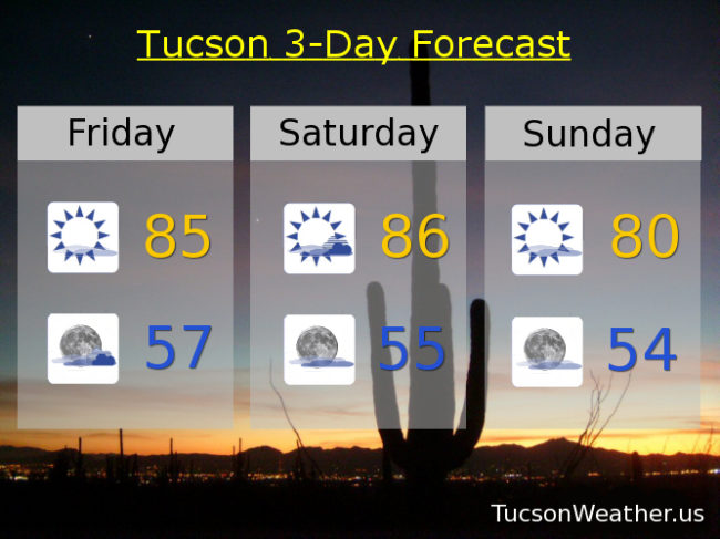
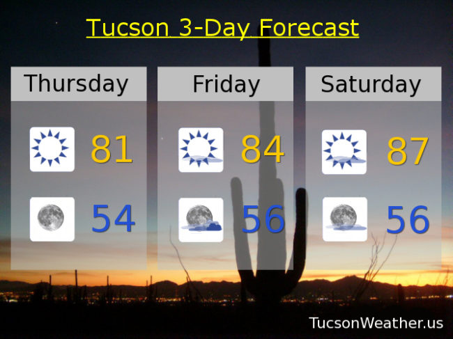
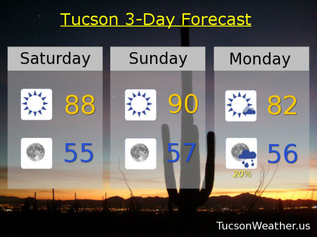
A slight chance for light rain showers tomorrow with a high near 80. Mostly sunny Wednesday through Sunday with highs in the low 80s.

Forecast for Sunday, November 5, 2017

A few high clouds in our forecast today and tomorrow for possible sunrise and sunset enhancement. Then a weak low moves across southern Arizona Tuesday for a chance at a few a showers. After that we chill with mostly sunshine and highs and lows a bit above average for early November. Enjoy!

Mostly sunny today with a high near 81.

Mostly clear tonight with a low in the low 50s.

Mostly sunny tomorrow near 80. Near 80 Tuesday with a chance for showers. Mostly sunny Wednesday through Monday with highs in the low 80s and lows in the low 50s.

Forecast for Saturday, November 4, 2017

Considerable high and mid level clouds streaming across the area will be with us much of the day. Maybe we’ll see some sprinkles or light rain today, but I wouldn’t count on it. Still warm too with highs in the mid 80s. The clouds get the heave ho (should that be hyphenated? I don’t know. I’ve never typed “heave ho” before) by tonight with slightly cooler highs and lows the next few days. A weak system moves across the state Tuesday for another slight chance for rain or sprinkles, but reality is, we will likely remain high and dry.

Partly sunny today with a high in the mid 80s.

Mostly clear tonight with a low in the mid 50s.

Mostly sunny tomorrow with a high near 80. Low 80s Monday. Partly sunny Tuesday low 80s. Mostly sunny Wednesday, Thursday and Friday low 80s ish.

Forecast for Friday, November 3, 2017

It’s Friiidaaay!

Low pressure over the west coast and high pressure over Mexico means we will be in a SWesterly flow and a bit warm for this time of year. Our average high for November 3rd is 79, so yeah. High clouds from time to time for possible sunrise and sunset enhancement. A weak disturbance in the force will give us a chance for showers Tuesday into Wednesday of next week. Time will tell and of course we’ll keep you posted. Stay tuned!

Mostly sunny today with a high near 85.

Partly cloudy tonight with a low in the upper 50s.

Partly sunny tomorrow with a high in the mid 80s. Mostly sunny Sunday near 80. Low 80s Monday. Partly sunny low 80s Tuesday and Wednesday. Sunny Thursday low 80s.

Forecast for Thursday, November 2, 2017

Temperatures just a tad on the warm side for this time of year. Still refreshingly cool on the deck for your morning coffee, but even the lows aren’t quite as low as they should be. The storm track is well to our north and that will be creeping closer as we go. The rain should be confined to the central and northern part of the state while we will see in increase in clouds for possible sunrise and sunset enhancement. Enjoy!

Sunny today low 80s. Mid 80s tomorrow. Upper 80s Saturday. Low 80s Sunday. Mid 80s Monday. Low 80s Tuesday.

Forecast for Wednesday, November 1, 2017

I for one welcome our new month of November overlords! Great start to the new month. All the leftover candy you can handle and pleasant temperatures. Highs just slightly above seasonal norms and lows slightly more. Averages for this time of year are 80 and 52 respectively so we aren’t far off. A few clouds from time to time over the next seven days for possible sunrise and sunset enhancement. Enjoy!

Mostly sunny today and tomorrow with highs near 81 and lows in the mid 50s.

Low 80s Friday. Mid 80s Saturday. Low 80s Sunday and Monday. Mid 80s Tuesday.

Forecast for Tuesday, October 31, 2017

It’s a good time to be a ghost or goblin. Thunder and lightning (shouldn’t it be lightning and thunder?) last night was a nice touch! Just a trace of rain on my perch here in southern Oro Valley, but someone in the OV got .90″! The light show was nice too. I hope you got some rain where you are. The Tucson International Airport got skunked again so we will end October officially high and dry with zero, zip, nada, nothing for the month of October. The low that brought us all this excitement has moved east and we are left with cooler, downright pleasant, weather in its wake. A batch of clouds will be moving over us later today with the possibility of a few sprinkles. Otherwise near average today through Tuesday with highs near 80 and lows in the mid 50s. A bit warmer Friday and Saturday with highs in the mid 80s. Then a low along the west coast will bring us some moisture with a very slight chance for showers and highs back to the low 80s Sunday and Monday.

Forecast for Monday, October 30, 2017

An upper level low continues to drop SSE along the California coast. It is expected to turn the corner later today and track across southern Arizona tonight. As a result we have scattered showers in the forecast with maybe an isolated thunderstorm or two, hopefully near you! Rainfall amounts are expected to be on the light side except for the mountains and those fortunate enough to get a storm. The system exits as quickly as it enters and we’ll be left with Sunny skies to start November. Tomorrows expected high of 80 is exactly average for this time of year. Yesterday’s 91 is likely to be the last 90 degree day of 2017. Enjoy!

Mostly sunny skies today with increasing clouds late for possible sunset enhancement. Today’s high near 85.

Scattered showers tonight with isolated thunderstorms possible becoming partly cloudy with a low near 58.

Mostly sunny tomorrow with a high near 80. Sunny mid 80s Wednesday, Thursday, Friday and Saturday. Low 80s Sunday.

Forecast for Sunday, October 29, 2017

Another really warm day before a weak storm system currently off the central California coast heads our way. It will sink toward Baja California before it takes a turn tomorrow and tracks along the International Border. As it moves to our south tomorrow night we’ll have a slight chance for light rain and cooler temperatures too. Halloween looks to be the ghoulist, er, I mean coolest, day of the seven day forecast with highs just a couple of degrees above average. After the low departs we’ll have a bit of a warming trend late next week as high pressure noses back into southern Arizona. Mornings remain refreshingly cool!

Sunny today with a high near 92.

Clear tonight with a low near 58.

Mostly sunny tomorrow with a high in the mid 80s and a chance for light rain Monday night. Partly cloudy Tuesday low 80s. Sunny low 80s Wednesday. Mid 80s Thursday, Friday and Saturday.

Forecast for Saturday, October 28, 2017

Maybe October won’t tie for the driest month on record after all! Or, maybe it still will, but there is a chance for light rain (half the calories of our regular rain) Monday night. Still warm this weekend, but at least the spell of mid 90s has been broken. Tomorrow will be the last 90 degree day of the year assuming the forecast comes exactly true. Then a weak storm system is forecast to track along the International Border giving us a chance for showers Monday night. Another system may head our way for later in the week. Whether that brings showers to our weather or not, temperatures will finally be where they are supposed to be for this time of year. Enjoy!

Sunny today with a high near 88. Near 90 tomorrow. Partly cloudy Monday with a chance for showers Monday night with a high in the low 80s. Mostly sunny Tuesday low 80s. Sunny Wednesday near 80. Low 80s Thursday and Friday.