Category Archives: Daily Forecast

Forecast for Tuesday, October 17, 2017

Make it stop! Mid October and it’s still in the 90s. Some interesting things going on with the forecast however. For example, high clouds streaming our way from the south will give us filtered sunshine today and possible sunset enhancement this evening. That’s always fun! Still hot though. Slightly cooler tomorrow and Wednesday as a weak disturbance moves through the state. Slight chance for a few showers to our north and northeast, but maybe. Another system to our north will bring us some cooling for the weekend with highs in the 80s to near 90. Unfortunately high pressure builds back in and we heat back up next week. Stay tuned!

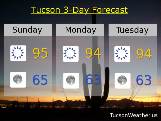
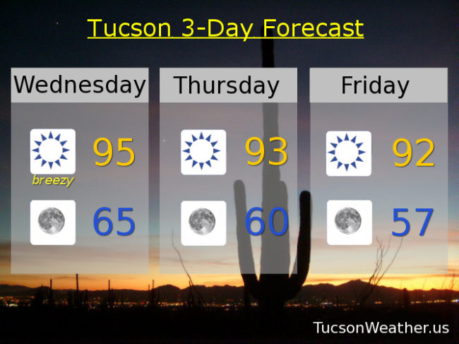
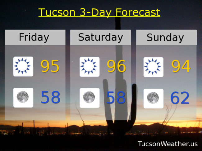
Some high cloudiness today with a high near 95.

Partly cloudy tonight with a low in the low 60s.

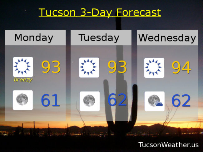
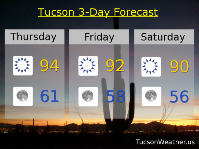
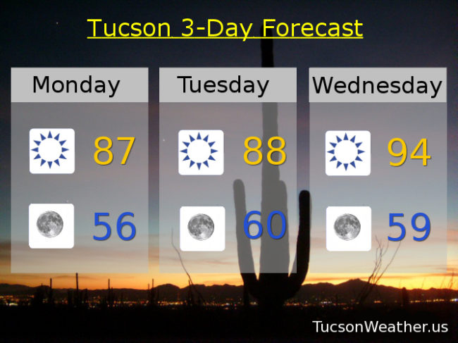
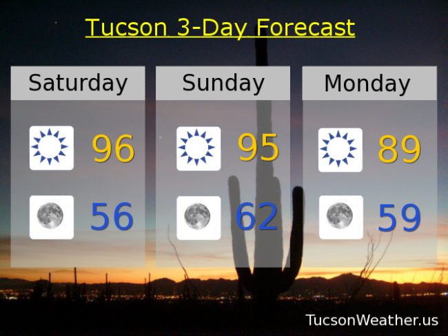
Mostly sunny tomorrow and Thursday with highs in the low 90s. Near 91 Friday. Upper 80s Saturday. Near 90 Sunday. Mid 90s Monday.

Forecast for Monday, October 16, 2017

Easterly breezes will pick up a little today. 10-20 mph gusting to near 30. High will remain in the low to mid 90s through Friday. Then a weak storm system will knock our highs down to near normal for this time of year. Still no rain expected in the Metro.

Breezy today with a high near 93. Sunny 93ish tomorrow. Near 94 Wednesday. Low 90s Thursday and Friday. Mid 80s Saturday and Sunday.

Forecast for Sunday, October 15, 2017

More of the same with high pressure ruling the roost and a strong cold front moving through Texas. As a result we’ll have some easterly breezes the next few days while staying on the warm side through most of the week. Life is tough when you are so hot! 🙂 A system moving through Utah to the Four Corners will cool us off a bit by the weekend, but rain will be confined to the mountains to our east. Stay tuned.

Sunny and warm today through Tuesday with east winds 5-15 mph gusting to around 20 and highs in the mid 90s. lows in the low to mid 60s.

Sunny and warm Wednesday and Thursday with highs in the mid 90s. Low 90s Friday. Upper 80s Saturday.

Forecast for Friday, October 13, 2017

It’s Friiiiidaaaaay!!! the 13!

No worries. Monday the 13th would be much worser. The weather remains pleasant enough if not kinda hot. High pressure south and east and low pressure well to the north has us in a persistent westerly flow keeping us high and dry. Good news on the distant horizon. Perhaps a storm system next weekend will bring a change. Cooler by the end of next week even if we don’t get rain. Until then more of the same. Stay tuned!

Sunny and warm through the weekend with highs in the mid 90s. Monday and Tuesday too. Sunny Wednesday low 90s. Upper 80s Thursday.

Forecast for Thursday, October 12, 2017

97 yesterday. Ugh. A bit cooler as we head into the weekend with storms well to our north. Still well above our average of 86 for this time of year. Lows back in the mid 50s by Saturday which is actually cooler than the average of 59. Warming back up starting Sunday into next week. There are a couple of TV job openings in Anchorage, Alaska. I’m thinking about it 🙂

Mid 90s today. Low 90s tomorrow. Near 90 Saturday. Mid 90s Sunday and Monday. Low 90s Tuesday and Wednesday.

Forecast for Wednesday, October 11, 2017

Some gusty east winds today relaxing by evening and warm with a high near 95. A storm missing us well to the north (My family in Oregon is expecting rain and mountain snow. Shocker!) will cool us off a few degrees. Lows a little below the average of 60 for this time of year. Highs above the average of 87 for this time of year and still bone dry. Low 90s Thursday through Tuesday with tons of Sun (you know, except at night).

Forecast for Monday, October 9, 2017

Columbus sailed the ocean blue in 14-hundred and 92. Happy Columbus Day Observed and Canadian Thanksgiving eh! I like to eat Italian food on Columbus Day, but then again I’m half Italian. I like to eat Italian food everyday! Breezes of change today as a trough of low pressure to our north will bring us some cooler air for today and tomorrow. High pressure builds back in mid week for a warm up back into the mid 90s. Then slightly cooler by the weekend.

Sunny and just a little bit breezy today with SE winds 5-15 mph. High in the upper 80s.

Clear tonight with a low in the mid 50s.

Sunny and a bit breezy tomorrow with ESE winds 5-15 mph and gusty and a high in the upper 80s. Sunny mid 90s Wednesday. Low 90s Thursday, Friday and Saturday. Near 90 Sunday.

Forecast for Friday, October 6, 2017

It’s Friiidaaay!

Looks like we made it (thank you Barry Manilow). 99 yesterday and the day before means it’s been hot for this time of year. It also means we didn’t hit 100! Small difference, I know, but it’s a psychological victory of sorts. Not as hot and a little bit breezy the next few days as a trough of low pressure will be over the northern Rockies. As that moves east we’ll be in a more NWesterly flow for further cooling. Nice to see 50s for morning lows returning to the forecast as we dry out.

Sunny today through Sunday with highs in the mid 90s. Near 90 Columbus Day. Upper 80s Tuesday. Low 90s Thursday and Friday.