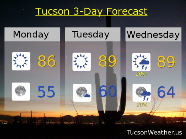
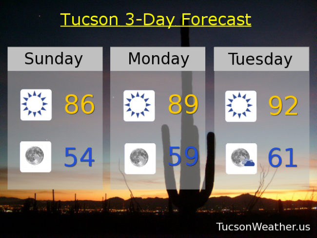
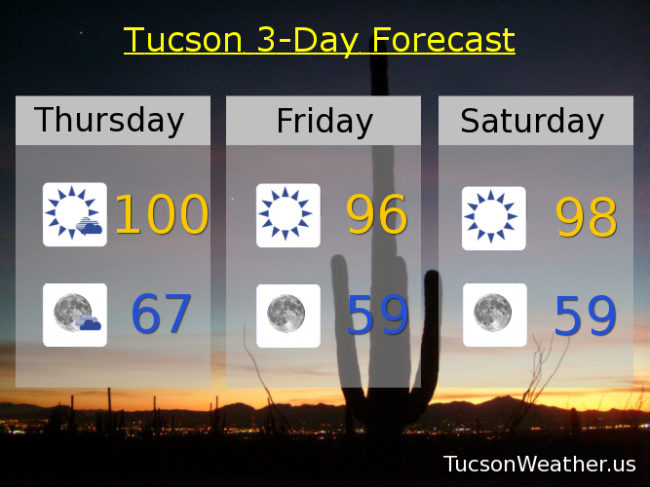
It’s National Poetry Day and I’m not quite sure what I want to say. 99 yesterday and 100 today! I’ll be happy when the heat goes away. Today’s record is 101. Let’s hope after today the 100s are done. The forecast says it’s true. That triple digits should be through. Storms well to our east yesterday may get closer today, but I wouldn’t expect any storms to come our way. Still kinda hot through Sunday with low 90s by Columbus Day. Upper 80s Tuesday. Near 90 Wednesday. We can’t control the weather with our current technology, but forecasts are getting better thanx to Meteorology. I’ll try not to worry about what I can’t control. And it’s nice to know that morning is best for a hike or a stroll.
Category Archives: Daily Forecast
Forecast for Wednesday, October 4, 2017
Happy 10-4 Day good buddy! Not sure that is a thing, but if it’s not it should be! The weather continues a bit on the warm side for this time of year. Today’s record high is 100 set in 1917 and we’ll be close with an expected high in the upper 90s. Moisture to our east could mean a few storms in Cochise County to the NM State line, but we should stay dry here in the Metro. A low to our north will move east giving us a more NWesterly flow by the weekend “cooling” us off just a bit by next week. Otherwise mostly clear sailing through Columbus Day and beyond. Upper 90s today through Saturday. Mid 90s Sunday. Low 90s Monday. Near 90 Tuesday.
Forecast for Tuesday, October 3, 2017
I love me some Twofer Tuesday. My favorite day of the week after Saturday, Sunday, Friday and Thursday 🙂 Steady as she goes with sunshine and warm temperatures. Looks like we will avoid record highs, but highs and lows will be above average for the beginning of October. Mid 90s today. Upper 90s tomorrow through Saturday. Mid 90s Sunday and Columbus Day (aka Canadian Thanksgiving in Canada eh).
Forecast for Saturday, September 30, 2017
Last day of Monsoon 2017. It was a wild ride! Started out really really hot. Then record rainfall in July. Then it shut down in mid August and it’s been pretty much dry since. Thanx to July we ended up 2 and a half inches above average for Monsoon 2017 and the 11th wettest ever! October starts tomorrow. Normally a dry time for us and that is the forecast. Sunny until further notice with highs in the mid 90s through Tuesday. Upper 90s Wednesday and Thursday. Mid 90s Friday. Lows in the mid to upper 60s. Very nice for that morning coffee on the deck. Final numbers for September and Monsoon 2017 coming tomorrow. Stay tuned!
Forecast for Friday, September 29, 2017
Today could get interesting. Moisture moving in from the east has made it to the Rincon and Catalina Mountains. Strong to isolated severe storms are possible east of town, but our local mountains might see some activity. The official forecast has no storms for the metro, but don’t be too surprised if we see some activity in and near the high country. The flow becomes more westerly than southwesterly and the moisture gets pushed out of here. The result will be tons of sunshine and highs in the mid 90s through Tuesday and upper 90s Wednesday and Thursday. Lows in the mid to upper 60s. Enjoy!
Forecast for Thursday, September 28, 2017
An upper level low was sitting over southern Utah this morning and is weakening and moving northeast. Moisture will increase from our east tomorrow and may make as far west as Tucson’s east side, so a slight chance for showers and storms in the Rincons and Catalina Mountains. It would be great if we could get a storm in town and maybe that will happen, but for right now it’s a remote chance. Temperatures warming into the mid 90s tomorrow and staying there through Wednesday with mostly sunny skies. Enjoy!
Forecast for Wednesday, September 27, 2017
An upper level low over the northern part of the state will keep us from warming up today with showers and storms well to the east and northeast of Tucson. Some strong storms are possible over the White Mountains if you are wandering that direction today. Once the low weakens and moves out we will start to warm up. Near 90 today with mostly sunny skies. Low 90s tomorrow. Mid 90s Friday, Saturday, Sunday, Monday and Tuesday.
Forecast for Tuesday, September 26, 2017
Looks like our low is gonna form further north than first expected, therefore showers and storms should be well to our east and northeast tomorrow. We’ll have a few clouds and a slow warm up this week. Upper 80s to near 90 today. 90ish tomorrow. Low 90s Thursday. Mid 90s Friday, Saturday and Sunday. Low 90s Monday. Enjoy!
Forecast for Monday, September 25, 2017
Chilly again this morning and tomorrow morning (mmm chili) with highs remaining below the average high of 92 for the next few days. A low forming in NW Arizona tomorrow will sink SE and pull moisture from the east and south for scattered storms east of Tucson. Will the moisture make it this far west? Time will tell. For now we have a 20% chance for storms Wednesday and Wednesday night and a 10% chance Thursday. Then a warm up as we close out September with highs in the low to mid 90s Friday, Saturday and Sunday.
Forecast for Sunday, September 24, 2017
It is chilly on the deck this morning! (mmm chili) 57 our low so far with a slightly chillier start forecast for tomorrow morning as the cooler air has settled in. Mid 80s this afternoon and upper 80s tomorrow with clear skies. An upper low is forecast to form to our west by Wednesday giving us a slight chance for showers and storms Wednesday and Thursday with a better chance to our east. We’ll see how that works out. Warming up with the new work week with highs in in the low 90s Tuesday, near 90 Wednesday with a 20% chance of rain, low 90s Thursday with a 10% chance of rain, low 90s Friday, mid 90s Saturday with a 10% chance of rain. Enjoy!