Forecast for Sunday, April 8, 2018

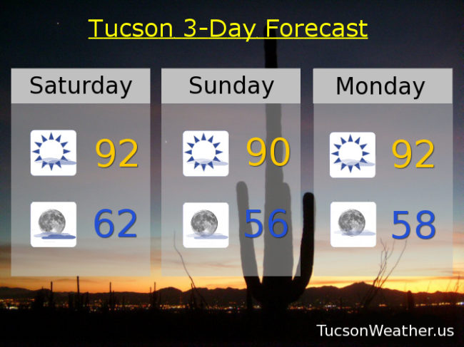
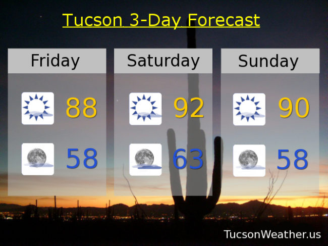
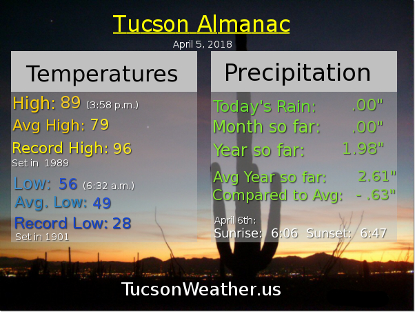
Sunny and not as hot today. Yesterday we hit our predicted 92. More like May than April, but it happens here in Tucson. A weak system to our north will knock back the heat a degree or three and bring us a bit of a breeze. NW winds this afternoon 5-15 mph and gusty with a high in the upper 80s to near 90. More of the same tomorrow sans the wind.

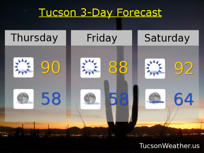
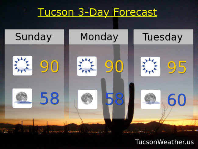
Then it’s high pressure flexing it’s muscles and bringing the heat. Mid 90s Tuesday and likely a record high Wednesday in the upper 90s.

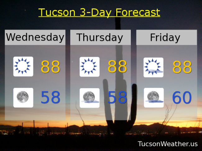
Then… A storm to our north kicks up the winds and brings a cool down. Breezy Thursday upper 80s. Upper 70s Friday! Near 80 Saturday. Enjoy!

Forecast for Saturday, April 7, 2018

The 90s are making a comeback! I don’t mean metal hair bands (but maybe), but I do mean yesterday’s high was right at 90 with 90 degrees or better (worser?) in the forecast through Wednesday of next week. Then a pattern change will knock our high pressure back a bit as a storm misses us to the north (of course). It’ll be breezy too (as well). Here is your forecast from the out of coffee so drinking tea folks at TucsonWeather.us

Mostly sunny today and a little bit breezy with a WNW wind 5-15 mph and gusty and a high near 92ish.

Mostly clear tonight with a low in the low 60s.

Sunny tomorrow near 90. Low 90s Monday. Mid 90s Tuesday. Upper 90s Wednesday! Sunny and breezy Thursday upper 80s. Near 80 Friday.

Forecast for Friday, April 6, 2018

Another warm day yesterday. It was the second day in a row with a high of 89. Quite a bit of high cloudiness this morning has our low not so low in the 60s to start your Friiidaaay!!! Low pressure moving through the Great Basin will start to kick up our winds today through the weekend. Not too insane, but breezy fo’ sheezy. High pressure builds in next week with the hottest weather so far this year! Be cool.

Becoming mostly sunny today but still some high cloudiness around for possible sunrise and sunset enhancement. Winds becoming westerly 10-20 mph and a high near 88ish.

Partly cloudy tonight with a low in the upper 50s.

Mostly sunny tomorrow with a westerly breeze 5-15 mph and gusty with a high in the low 90s. Sunny Sunday near 90. Low 90s Monday. Mid 90s Tuesday and Wednesday. The spell is broken Thursday with breezes and a high in the upper 80s.

Forecast for Thursday, April 5, 2018

Forecast is trending warmer and breezier as we head toward the weekend. Even warmer still early next week! It’s getting to be that time of year although the average high this time of year is 79, so low 90s Saturday is pushing it a little. A system missing us to the north will increase our clouds and breezes. Perhaps sunrise and sunset enhancement will be a thing. Keep your Samsung Galaxy S9 iPhone X Pixel 2 XL handy just in case!

Mostly sunny today near 90ish.

Mostly clear tonight upper 50s.

Mostly sunny tomorrow and a bit breezy with a high in the upper 80s to near 90. Breezy and warm Saturday low 90s. Sunny Sunday upper 80s. Low 90s Monday. Mid 90s Tuesday! Low 90s Wednesday. Enjoy!

Forecast for Wednesday, April 4, 2018

Steady as she goes as highs will be in the upper 80s the next three days. Up two or three from yesterday’s high of 85. There will be more wind in our sails as we head into the weekend. A pretty large storm will, of course, miss us to the north (that time of year) but the breezes will kick in a bit on Friday and more so Saturday and Sunday. A few more clouds too, but staying warm with Saturday’s high near 90 and upper 80s Sunday. Back to 90ish Monday and low 90s Tuesday! Be cool.