Forecast for Tuesday, April 3, 2018

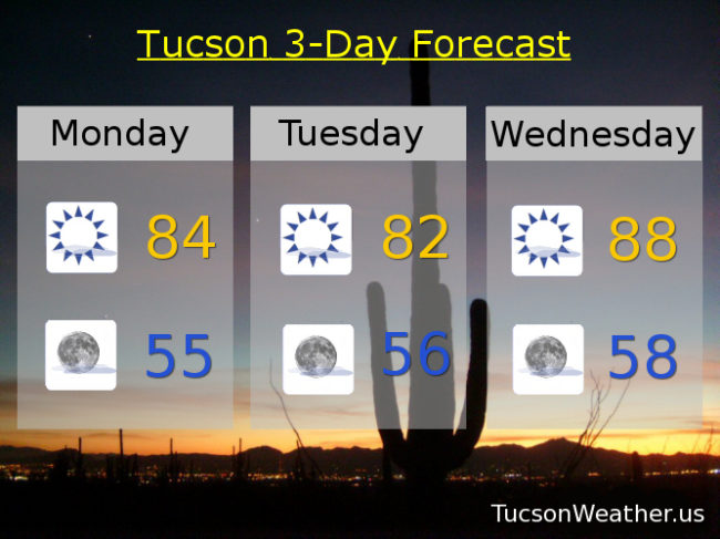
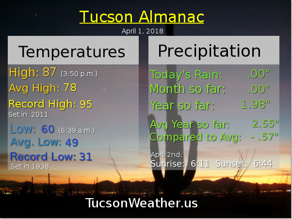
Not a lot of excitement in today’s forecast unless you like high temperatures approaching 90 degrees. A weak trough missing us to the north is moving east today leaving a NWesterly flow in it’s wake. That just means we’ll be a couple three degrees cooler that yesterday’s high of 87. Nuthin’ but sunshine and a light westerly breeze 5-10 mph. Today’s high in the mid 80s.

Mostly clear tonight with a low in the mid 50s.

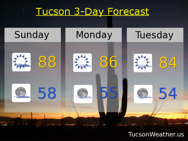
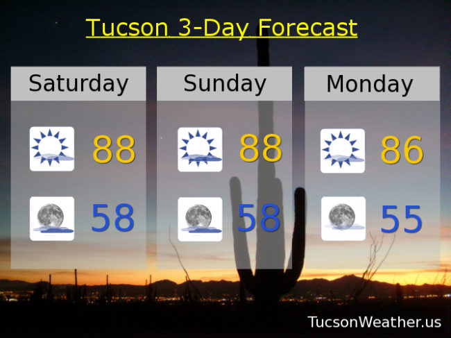
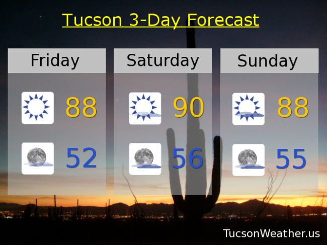
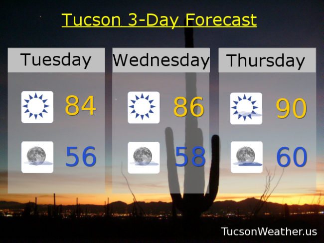
High pressure building back in for the rest of the week. Sunny tomorrow mid 80s. Upper 80s to near 90ish Thursday. Mostly sunny upper 80s Friday and Saturday. Mid 80s Sunday. Upper 80s to near 90 Monday. Enjoy!

Forecast for Monday, April 2, 2018

A weak disturbance in the force is moving through the area today with not a lot of clouds and just a slight cool down. Temperatures still above average and the breezes will be kicking up this afternoon out of the SW 10-20 mph gusting over 25 perhaps. This afternoon’s high in the mid 80s.

Mostly clear skies tonight with winds relaxing and a low near 55ish.

Cooler tomorrow with sunny skies and a high in the low 80s.

High pressure building back in for the remainder of the forecast and getting kinda hot. Upper 80s Wednesday. Near 90 Thursday. Upper 80s Friday. Near 90 Saturday. Upper 80s Sunday. Enjoy!

Forecast for Sunday, April 1, 2018

Easter, April Fool’s Day and my brother’s birthday all rolled into one! It is going to be an amazing day! A weak disturbance in the force riding through the high pressure has clouded us up rather nicely and may lead to a somewhat breezy afternoon. Still on the warm side with partly sunny skies and a high today in the upper 80s. SW breezes this afternoon 5-15 mph and gusty.

Partly cloudy tonight with a mild low in the upper 50s.

Most sunny and breezy tomorrow with SW winds 10-20 mph and a high in the mid 80s.

Mostly sunny Tuesday mid 80s. Upper 80s Wednesday, Thursday and Friday. Near 90 Saturday. Enjoy!

Forecast for Saturday, March 31, 2018

March is going out like it came in, like a lamb. High pressure has taken control with very warm temperatures for this time of year. Despite that, plenty of high clouds in our forecast this weekend for possible sunrise and sunset enhancement. Yesterday’s high of 85 was a couple three degrees “cooler” than forecast. Today’s expected high in the upper 80s to maybe 90 should (should) mean that the record of 91 will stay safe.

Mostly cloudy tonight with a low in the upper 50s.

Partly sunny Easter Sunday and warm with a high in the upper 80s. Mostly sunny Monday mid 80s. Sunny Tuesday mid 80s. Mostly sunny Upper 80s Wednesday, Thursday and Friday. Enjoy!

Forecast for Friday, March 30, 2018

Temperatures still going up as high pressure continues to build in, peaking tomorrow near the record high of 91. We’ll see. It’s a dirty high meaning there will be high clouds from time to time hopefully leading to sunrise and sunset enhancement! Considerable high cloudiness Sunday into Monday not out of the question and maybe even a few sprinkles. It shouldn’t amount to anything. It’ll stay warm too. Enjoy!

Sunny today upper 80s. Mostly sunny tomorrow near 90. Partly sunny Easter Sunday upper 80s. Becoming mostly sunny Monday mid 80s. Sunny Tuesday and Wednesday upper 80s. Mostly sunny Thursday upper 80s.