
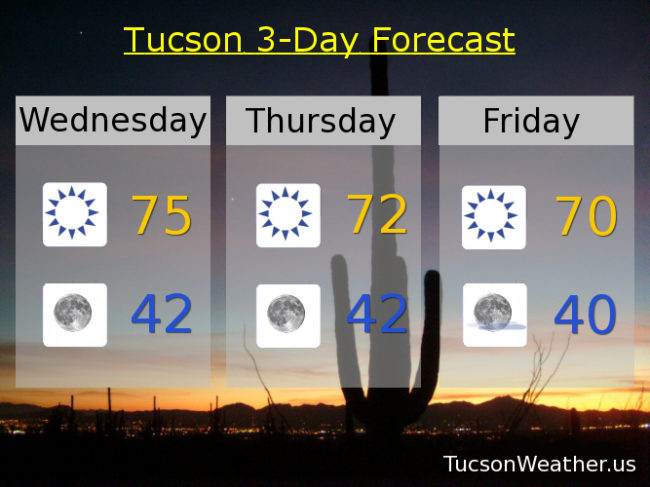
Forecast for Wednesday, December 13, 2017
The forecast is trending cooler than thought yesterday which is good news for you trending cooler folks. Not to worry you warm mongers, we’ll be warming up again next week and today and tomorrow will be nice. High pressure moving to the west will open the door for a couple of systems to miss us to the north and east as they dive out of the northern Rockies into New Mexico. We’ll stay dry, but cooler air will move in behind each one. The first system will breeze by tomorrow and the second Sunday/Monday. The high pressure builds back in for a warming trend the rest of next week. Enjoy!
Sunny today and warm after a cool start. Today’s high near 75ish.
Clear tonight with perfect viewing conditions for the peak of the Geminid Meteor Shower. Low near 42.
Sunny and cooler tomorrow and Friday with highs in the low 70s to near 70 respectively. Mostly sunny near 70 Saturday. Upper 60s Sunday. Near 70 Sunday. Low to mid 70s Monday.
Almanac for Tuesday, December 12, 2017

Forecast for Tuesday, December 12, 2017
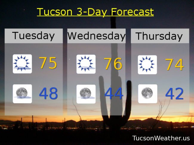
High pressure moving in with lots of luggage is planning on staying awhile. Low pressure to our south and west slowly moving south and west taking most of the high cloudiness with it by tomorrow. A bit of an east breeze today 5-15 and gusty and a high near 75. Mid 70s for highs and low to mid 40s for lows through Monday. Enjoy!
Almanac for Monday, December 11, 2017

Forecast for Monday, December 11, 2017
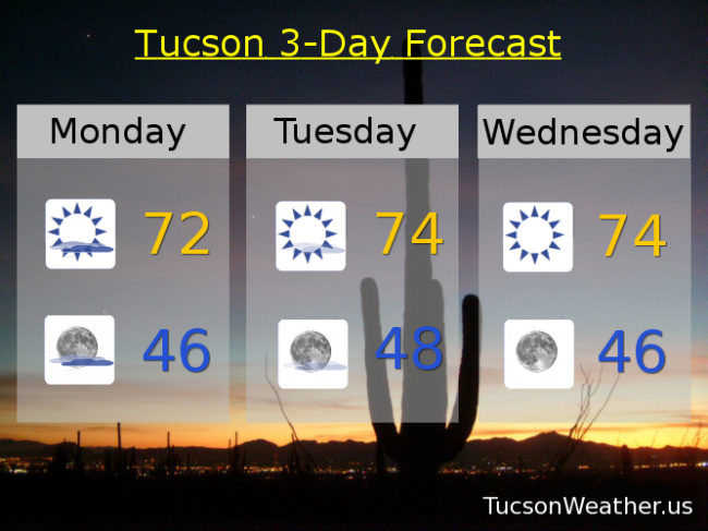
73 has been our high for the last two days. Expect similar readings for the next few at least. A low over the Baja Peninsula will slowly drift east over northern Mexico continuing to feed high clouds into southern Arizona for possible sunrise and sunset enhancement. Clearing skies by Wednesday as high pressure over the west rules to roost. We’ll continue with highs in the low to mid 70s into next weekend with lows in the mid to upper 40s. Enjoy!
Almanac for Sunday, December 10, 2017

Forecast for Sunday, December 10, 2017
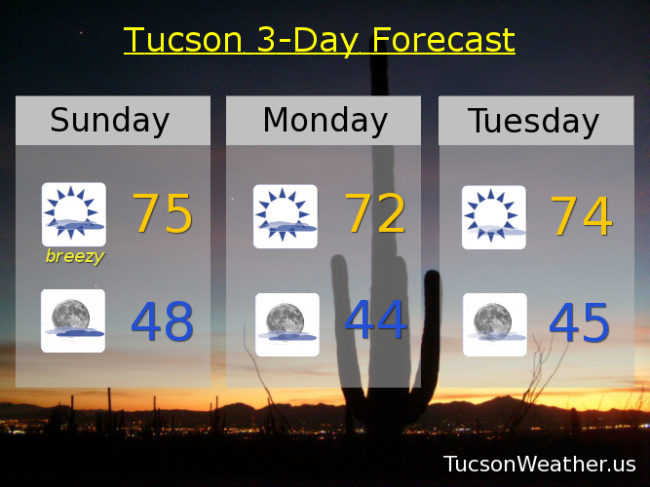
An upper level low just off the coast of Baja California will be tracking just to our south over northern Mexico tomorrow through Wednesday bringing plenty of high clouds with it for possible sunrise and sunset enhancement. Rain chances confined to northern Mexico and maybe southern Cochise county, but we will stay dry here in the metro. Breezy today with ESE winds 10-20 mph gusting to around 30 with a high in the mid 70s. That’s 10 degrees above average for this time of year! The clouds overnight will keep some of the “heat” from escaping into space (echo space… space.. space..) so lows not as low. Upper 40s to start the day tomorrow. That’s about 9 degrees above average for this time of year. Clouds start to thin Tuesday into Wednesday. Highs in the low to mid 70s. Sunny Thursday, Friday and Saturday with highs in the mid 70s and lows in the mid 40s. Enjoy!
Almanac for Saturday, December 9, 2017
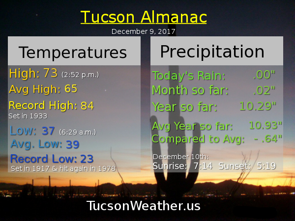
Forecast for Saturday, December 9, 2017
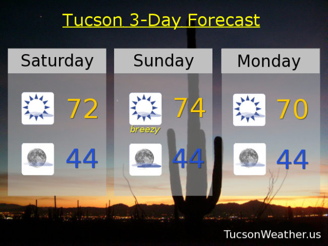
A warming trend this weekend as high pressure gains strength over the west. Very pleasant this afternoon after a chilly start (mmm chili). A bit breezy this afternoon with east winds 10-15 mph and gusty and a high near 72. A low will move through Mexico tomorrow giving the southern half of Cochise county a slight chance of light rain. For us it means a bit more of a breeze and a few more clouds for possible sunrise and sunset enhancement and a high near 74ish. Mostly sunny Monday near 70. Mid 70s Tuesday, Wednesday, Thursday and Friday.