
Almanac for Saturday, October 7, 2017

Forecast for Saturday, October 7, 2017
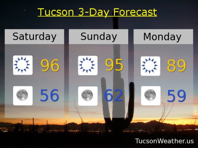
Kinda chilly (mmm chili) on the deck this morning. Bone dry air giving us a 40 degree in temperature swing today! 57 this morning to 96 this afternoon to 56 tomorrow morning. Still a bit of a breeze the next few afternoons, but not too windy. Cooling to the upper 80s Columbus Day and then warming a bit next week. Near 90 Tuesday. Low 90s Wednesday through Friday.
Almanac for Friday, October 6, 2017

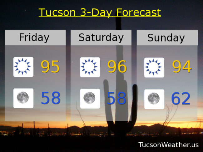
Forecast for Friday, October 6, 2017
It’s Friiidaaay!
Looks like we made it (thank you Barry Manilow). 99 yesterday and the day before means it’s been hot for this time of year. It also means we didn’t hit 100! Small difference, I know, but it’s a psychological victory of sorts. Not as hot and a little bit breezy the next few days as a trough of low pressure will be over the northern Rockies. As that moves east we’ll be in a more NWesterly flow for further cooling. Nice to see 50s for morning lows returning to the forecast as we dry out.
Sunny today through Sunday with highs in the mid 90s. Near 90 Columbus Day. Upper 80s Tuesday. Low 90s Thursday and Friday.
Almanac for Thursday, October 5, 2017

Forecast for Thursday, October 5, 2017
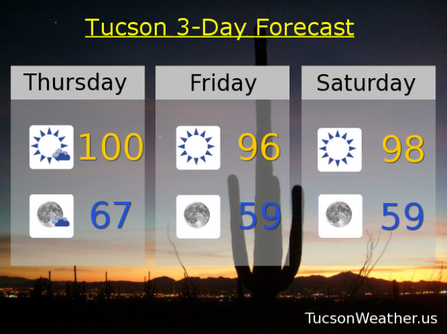
It’s National Poetry Day and I’m not quite sure what I want to say. 99 yesterday and 100 today! I’ll be happy when the heat goes away. Today’s record is 101. Let’s hope after today the 100s are done. The forecast says it’s true. That triple digits should be through. Storms well to our east yesterday may get closer today, but I wouldn’t expect any storms to come our way. Still kinda hot through Sunday with low 90s by Columbus Day. Upper 80s Tuesday. Near 90 Wednesday. We can’t control the weather with our current technology, but forecasts are getting better thanx to Meteorology. I’ll try not to worry about what I can’t control. And it’s nice to know that morning is best for a hike or a stroll.
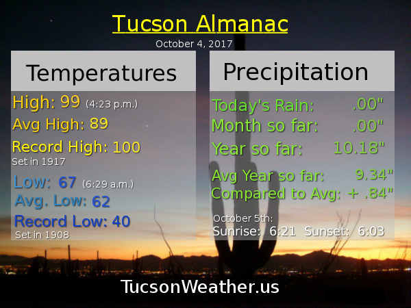
Almanac for Wednesday, October 4, 2017
Forecast for Wednesday, October 4, 2017
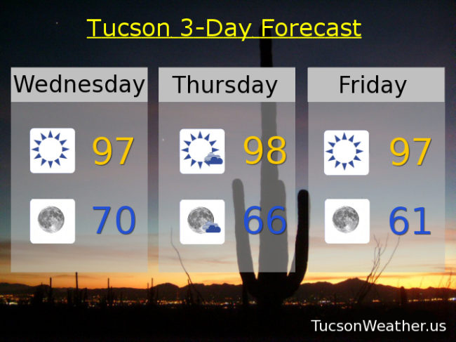
Happy 10-4 Day good buddy! Not sure that is a thing, but if it’s not it should be! The weather continues a bit on the warm side for this time of year. Today’s record high is 100 set in 1917 and we’ll be close with an expected high in the upper 90s. Moisture to our east could mean a few storms in Cochise County to the NM State line, but we should stay dry here in the Metro. A low to our north will move east giving us a more NWesterly flow by the weekend “cooling” us off just a bit by next week. Otherwise mostly clear sailing through Columbus Day and beyond. Upper 90s today through Saturday. Mid 90s Sunday. Low 90s Monday. Near 90 Tuesday.
Almanac for Tuesday, October 3, 2017
