
Forecast for Thursday, May 4, 2017
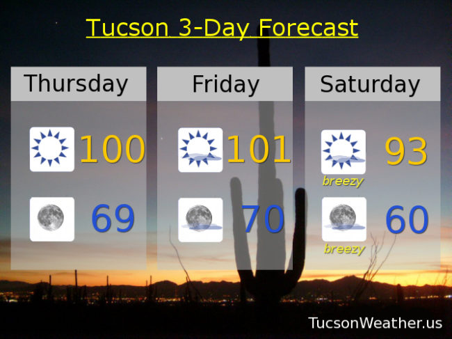
It’s a little early, but it looks like today will be our first 100 degree day of the year. If we manage to fall just short we’ll hit it tomorrow. Don’t get used to it. A strong storm approacheth for increasing wind and decreasing temperatures this weekend and a chance for showers and storms by Tuesday. Stay tuned!
Sunny and hot today with a high near 100.
Clear skies tonight with a low in the upper 60s to near 70.
Sunny and hotter tomorrow with a high near 101. Breezy and cooler Saturday with a high in the low 90s. Breezy Sunday low 80s. Breezy Monday mid 70s. Scattered showers and thunderstorms possible Tuesday mid 70s. Mostly sunny Wednesday low 80s.
Almanac for Wednesday, May 3, 2017

Forecast for Wednesday, May 3, 2017
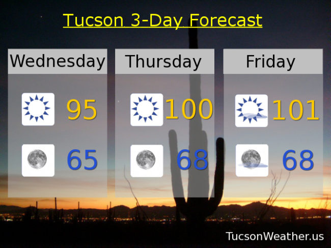
Hot until it’s not. High pressure building in with our first 100 degree day of the year likely tomorrow or Friday. Then a strong storm system approacheth with wind, cooling temperatures and maybe some showers early next week. Stay tuned!
Sunny today with a high in the mid 90s.
Clear skies tonight with a low in the mid 60s.
Sunny tomorrow and Friday near 100. Breezy Saturday mid 90s. Breezy Sunday low 80s. Breezy Monday upper 70s. Slight chance of storms Tuesday upper 70s.
Almanac for Tuesday, May 2, 2017

Forecast for Tuesday, May 2, 2017
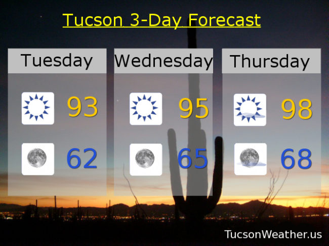
Our old pal high pressure bringing nuthin’ but Sun and increasing heat as we cruise through the week. Spring breezes return this weekend as a strong storm approacheth. A chance for showers or a storm as the system moves through Monday and Tuesday? Stay tuned!
Sunny today with a high in the low 90s.
Clear skies tonight with a low in the low 60s.
Sunny mid 90s tomorrow. Upper 90s Thursday. Near 100 Friday. Breezy Saturday upper 90s. Breezy Sunday upper 80s. Breezy Monday with a slight chance of a shower or storm near 80.
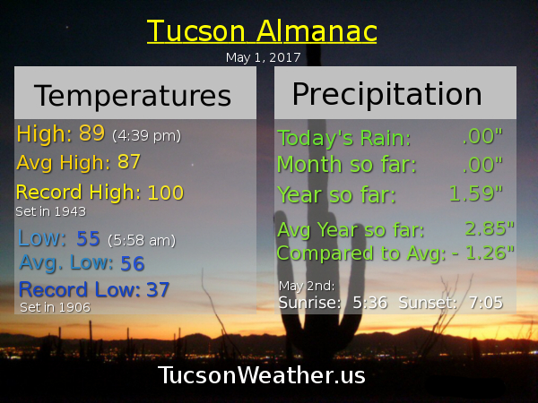
Almanac for Monday, May 1, 2017
Forecast for Monday, May 1, 2017
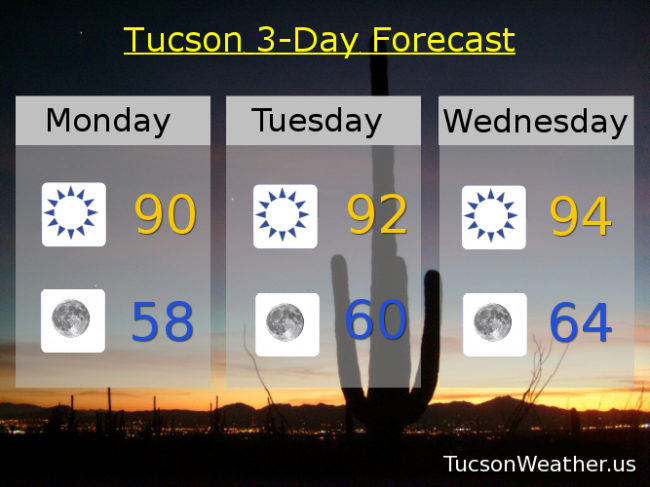
An AMAZING day yesterday! Not too bad today and if you like it a little warmer. If so you’ll like the reminder we are getting this week that we are now in May. Can June be far behind? High pressure building in for nuthin’ but Sun and a warming trend. Still looks like near 100 for Friday. Breezy and cooler to start the weekend. Stay tuned!
Sunny today with a high near 90.
Clear tonight with a low near 60.
Sunny tomorrow low 90s. Mid 90s Wednesday and Thursday. Near 100 Friday. Breezy Saturday mid 90s. Breezy Sunday near 90.
Almanac for Sunday, April 30, 2017
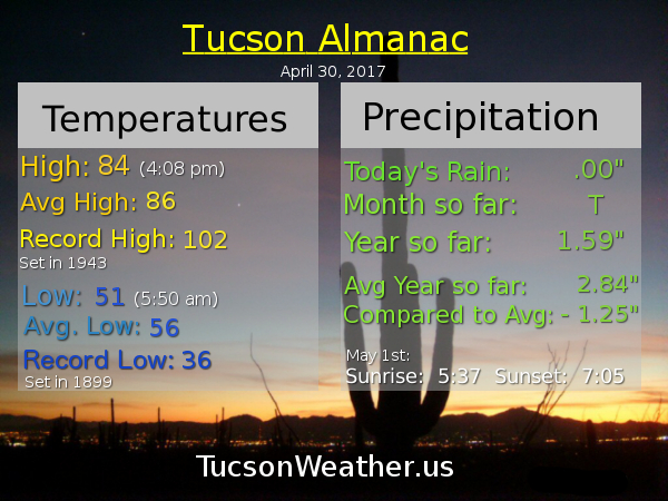
Forecast for Sunday, April 30, 2017
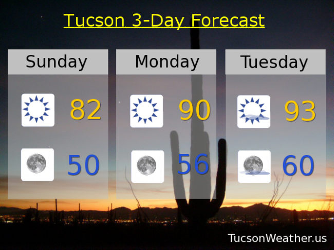
Let the warming trend begin! The system that brought snow to New Mexico, Texas, Colorado and other places that aren’t here has moved off to the east. The wind is done! Mostly. High pressure building in and we could see our first 100 degree day by Cinco de Mayo. Margaritas all around! Cheers!
Sunny today with a NW breeze 5-15 mph and a high in the low 80s.
Clear skies tonight with a low near 50.
Sunny tomorrow near 90. Low 90s Tuesday. Mid 90s Wednesday & Thursday. Near 100 Friday. Upper 90s Saturday.