Forecast for Monday, June 8, 2020

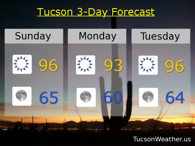
Happy Monday! Not an oxymoron. Not around here…

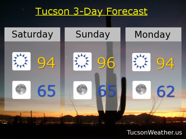
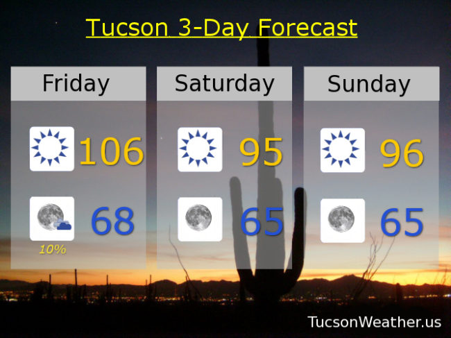
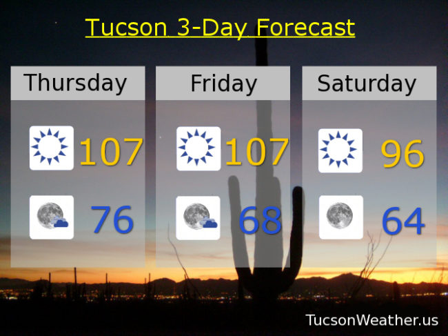
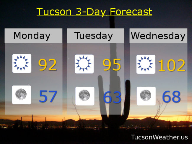
Gotta keep it positive! It will be nice and relatively cool this afternoon. That is the good news. Unfortunately the winds will be kicking up today too. Bad news for the Bighorn Fire. Not great for you wind haters either. (you know who you are 🙂 ) WNW breezes 10-20 mph gusting over 25 so there’s that. High in the low 90s! Warming up as we go through the week… mid 90s tomorrow. 102 Wednesday. 105 Thursday. 106 Friday. 105 Saturday. 103 Sunday. Enjoy!

Forecast for Sunday, June 7, 2020

It’s good to be below average! 99 (I’ve been waiting so long) is our average high for this time of year. Just 94 yesterday! Nice. Even cooler for tomorrow! Not bad today either with mid 90s to finish the weekend, although it will be on the windy side to fan the flames on the mountain. Getting hot again later this week, so make hay while the Sun isn’t as scorching, or something…

Sunny mid 90s today with SW winds 10-20 gusting to near 30. Winds relaxe tonight with clear skies mid 60s. Low 90s tomorrow! Mid 90s Tuesday. 103 Wednesday. 106 Thursday, Friday, and Saturday. Enjoy!

Forecast for Saturday, June 6, 2020

Time for. A cool change. I know that it’s time for. A cool change… Excessive Heat Warnings are gone for now and good riddance! The highs are lower and the lows are AMAZING! Heat returns next week, so make the most of this nice June Tucson Weather!

Sunny today, tomorrow, Monday, and Tuesday mid 90s. Lows in the mid 60s. Low 60s Tuesday morning! Warmin’ up Wednesday 104. 106 Thursday and Friday. Enjoy!

Forecast for Friday, June 5, 2020

It’s Friiidaaay!!!

Only 108 yesterday. I mean compared to the record of 112 I’d say we done good. EXCESSIVE HEAT WARNING for one more day, so be warned, the heat will be excessive. Brezzy fo Sneezy today too with WSW winds 10-20 mph gusting to near 30ish. High this afternoon of 106. A 10% chance for a storm or three (hopefully near you) this evening and a low in the upper 60s.

Today’s breezes bringing in cooler air for the weekend. Mid 90s tomorrow and Sunday!

Mid 90s Monday and Tuesday as well. Heating back up mid week. 102 Wednesday. 106 Thursday. Be Cool

Forecast for Thursday, June 4, 2020

It’s Friday Eve! (makes the weekend seem closer…)

It’s too hot. Too hot baby. Gotta run for shelter, gotta run for shade… EXCESSIVE HEAT WARNING in effect today and tomorrow. Be warned, the heat will be excessive. 107 both days. Ouch. Some breezes kicking up tomorrow. Not quite breezy fo sneezy levels, but out of the SW 10-15 and gusty so there’s that. It’s good news with cooler air on the way! Mid 90s Saturday. Upper 90s Sunday. Mid 90 Monday. Upper 90s Tuesday. 101 Wednesday. Be Cool 😎