Staying on the cool side as a system that missed us to the north yesterday exits and another system is set to miss us to the north tomorrow tomorrow night. Unfortunately staying dry this far south but a few clouds this evening and tomorrow for possible sunset and sunrise enhancement. Looking really interesting around the middle of next week as a cold storm currently in the Bering Sea chugs our way for a better chance for rain and mountain snow. How low will the snow level go? We’ll keep a close eye on it and let you know as it gets closer. Stay tuned!
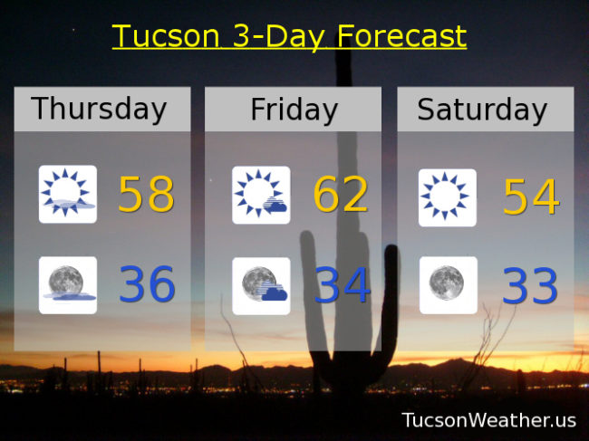
Mostly sunny today with a high in the upper 50s.
Mostly clear skies tonight with a low in the mid 30s.
Mostly sunny to partly cloudy tomorrow and breezy with west winds 10-20 mph by afternoon and a high in the low 60s. Sunny and cool Saturday mid 50s. Near freezing Sunday morning with high near 60. Upper 60s Monday and Tuesday. Chance for showers Wednesday low 60s.