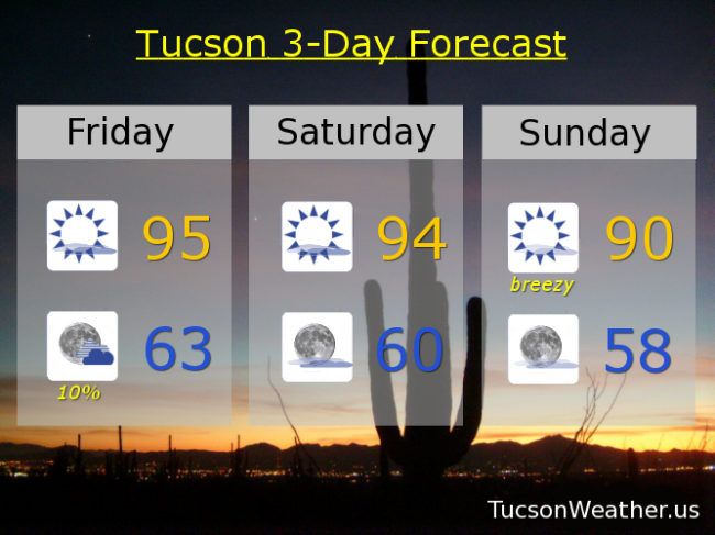
95 again yesterday for the third day in a row. Not bad really. A little warm, but it hasn’t been bothering me. We’ll be right there again today, but with some changes. A trough moving through from the west combined with a bit more moisture will give us a slight chance for a storm or two this evening. The best chance will be near the mountains. It’s still too dry at the surface, so if we do manage a storm or two expect more wind and dry lightning than rain. That could be fire dangerous! Still, it’ll be nice to see some build ups as long as lightning doesn’t go pyro on us. Late in the weekend we transition to cooler and breezy weather as a couple of storms miss us to the north. Still kinda Spring!
Mostly sunny today with a SW breeze this afternoon 5-15 mph and gusty with a high near 95ish.
Slight chance for an isolated storm or two this evening. Gusty winds near showers. Becoming mostly clear overnight with a low in the low 60s.
Sunny tomorrow with a high in the mid 90s. Breezy Sunday with SW winds gusting over 30 and a high near 90. Breezy Monday mid 80s. Breezy Tuesday low 80s. Upper 70s Wednesday. Low 80s Thursday.