Ah, Spring! Warming up, cooling down, and warming up again. Lather rinse repeat with some breezes in the transitions. Another warm day in the low 90s today with some high clouds for possible sunrise and sunset enhancement. Then a storm missing us to the north will bring gusty winds on Saturday. The National Weather Service has issued a FIRE WEATHER WATCH for Saturday afternoon and evening, so go out and watch for fires. Cooler temperatures on Sunday behind the departing storm. Cooler meaning near 80 which is exactly average for this time of year. Then we warm up to near 90 by Tuesday before another system misses up to the north with some breezes and slight cooling Wednesday. Warmer on Thursday. Such are the ins and outs of Spring’s ups and downs.
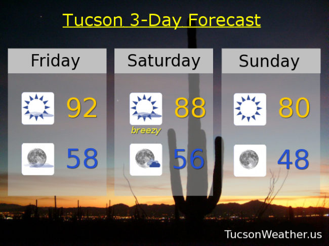
Mostly sunny today with a high this afternoon in the low 90s.
Mostly clear skies tonight with a low in the upper 50s.
Breezy tomorrow with thicker high clouds. West southwest winds 15-20 mph gusting to near 30 and a high in the upper 80s. Did I mention the FIRE WEATHER WATCH in effect from Noon until 6:00 in the evening?
Sunny and cooler Sunday with a high near 80. Low 80s Monday. Near 90 Tuesday. Breezy mid 80s Wednesday. Near 90 Thursday.