It’s Friiidaay!
Parting is such sweet sorrow. Great rains for Marana and Pictures Rocks and other western locations last night after flooding rains yesterday afternoon on the south side. Today may be as active as yesterday or maybe not quite as we hold on to moisture one more day before the great Monsoon dry out of 2017. High pressure building to our west bring drier air tomorrow and then moving to our south keeping the moisture from returning. That reverses itself toward the end of next week for the great Monsoon 2017 come back! Until then and starting tomorrow it’s higher highs and refreshingly lower lows. Stay tuned!
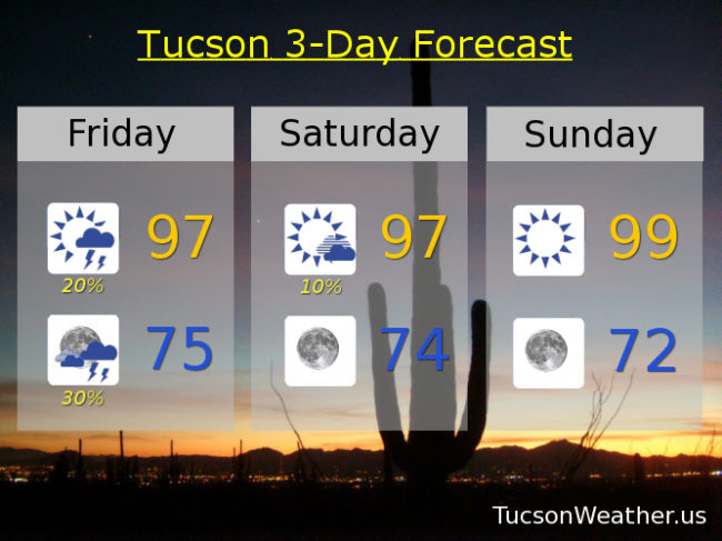
Mostly sunny becoming partly sunny this afternoon with scattered storms and a high in the upper 90s.
Scattered storms tonight with a low in the mid 70s.
An isolated storm at best tomorrow with mostly sunny skies and a high in the upper 90s. Sunny upper 90s to near 100 Sunday. 100 Monday. 102ish Tuesday. Isolated storms Wednesday 103. Widely scattered storms Thursday near 100.