It just gets interestinger and interestinger! Last night’s storm was amazing. Rain started about 4:00 yesterday afternoon and didn’t let up until about 9:00! Then off and on showers overnight with sticking snow repoerted in Corona de Tucson (thank you Tina!) and also from Vail east as snow levels did indeed crash down to 3,500 feet. The airport picking up a third of an inch (.34″) of rain before midnight. Decreasing clouds today as our storm exits stage east. It’ll be cold with the FREEZE WARNING still a go from midnight tonight until 9:00 a.m. Saturday morning and then again midnight until 9:00 a.m. Sunday. However. Saturday night/Sunday morning is looking interestinger. Our storm still lingering to our east could trigger some snow showers perhaps as far west as Tucson? No showers yet included in the Metro’s official forecast but a slight chance has been added for Summerhaven. Stay tuned there. THEN another storm approacheth for New Year’s Eve into New Year’s Day that originally looked like it was going to miss us to the east may actually give us a chance for rain/snow? The official forecast keeps us dry right now. Again. Stay tuned there as we have a lot to sort out yet in 2018!
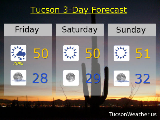
Decreasing clouds today but still a chance for a lingering rain or snow shower before 8 a.m. and a high this afternoon near 50ish. Mostly clear tonight with a low in the upper 20s. Sunny tomorrow near 50ish. Upper 20s Sunday morning. Sunny Sunday low 50s. Mostly sunny Monday mid 50s. Sunny New Year’s Day low 50s. Mid 50s Wednesday. Mid 60s Thursday.