Cinco de Mayo on a Friiiiiidaaaaay! That is pretty good planning. Another hot day before a dramatic change in the weather pattern cools us off and brings a chance for showers and thunderstorms by Tuesday of next week. We hit 100 for the first time this year yesterday afternoon at 2:34. Today should be at least as hot with an expected high of 101. Then a strong storm approacheth which will kick up the winds and drive a cold front through southern Arizona. It will be much cooler. That’s what cold fronts do. A FIRE WEATHER WATCH is in effect tomorrow so be careful setting stuff on fire. As the storm moves through early next week we could see showers and storms. That would be nice. Hopefully one or two near you. Stay tuned!
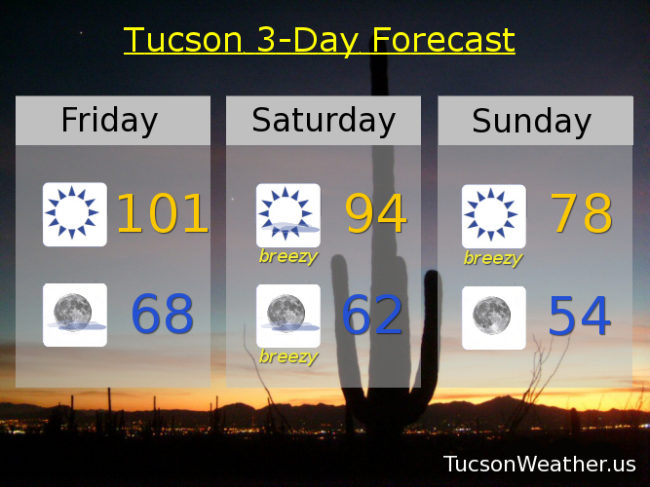
Sunny today with a high near 101.
Mostly clear skies tonight with a low in the upper 60s.
Mostly sunny and breezy tomorrow with SSW winds 20-25 mph gusting around 35 and a high in the mid 90s.
Sunny breezy and cooler Sunday with SW winds 15-25 mph gusting over 30 and a high in the upper 70s.
Mostly sunny with a slight chance of rain Monday and a high in the low 70s. Scattered showers and storms Tuesday mid 70s. Slight chance of showers Wednesday low 80s. Sunny upper 80s Thursday.