The times they are a changin’. Rain is back in the forecast by the end of the week and into the weekend! High pressure still to our west with some high clouds later today into tonight for possible sunset enhancement. Keep those camera devices handy. A system missing us to the north will give us partly sunny to mostly cloudy skies tomorrow into Wednesday. On Wednesday a storm off the central California coast will start to break down the high to our west and open the door for a stronger storm this weekend. Perhaps some light showers (half the calories of our regular showers) on Friday with a bit of snow above 7,500 feet. Then a better chance for rain and mountain snow Saturday and Saturday night. Stay tuned!
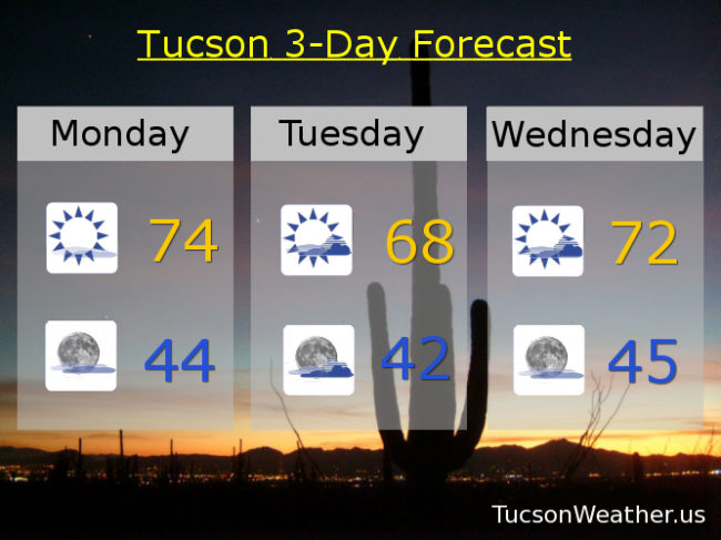
Sunny today with some high cloudiness and a high in the mid 70s. Partly cloudy tonight with a low in the mid 40s. Mostly cloudy tomorrow upper 60s. Partly sunny Wednesday low 70s. Mostly sunny Thursday low 70s. 10% chance for showers Friday upper 60s. 20% Saturday upper 60s. 30% Saturday night low 40s. Mostly sunny Sunday 65ish. Enjoy!