What a Monsoon! The airport picked up another third of an inch yesterday. We are now officially over 4 inches so far this month! The average for the entire Monsoon is just over 6 inches so we are well on our way. Our disturbance in the force is north of us today so best chances of rain will be to our north, but we still have plenty of moisture around for scattered storms this afternoon. More of a southerly flow today so storms that do form will be moving to the north so the threat of heavy rain is somewhat diminished. We start to dry out and subsequently warm up tomorrow into Thursday but still a storm or two, hopefully near you. Moisture surges again Friday into the weekend with an uptick in storms expected. Viva Monsoon 2017!
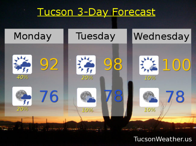
Partly sunny today with scattered afternoon and evening storms and a high in the low 90s.
Becoming partly cloudy tonight with a few storms before midnight and a low in the mid 70s.
Mostly sunny with isolated storms Tuesday, Wednesday and Thursday with highs near 98, 100 and 99 respectively. Scattered storms possible Friday, Saturday and Sunday with highs near 97, 95 and 96.