Well that was fun! The Foothills, Oro Valley and Marana the big winners with last night’s storms. It’s fixin’ to get even funner for those who missed out last night. Just a trace at the airport yesterday, but the OV received a half inch to three-quarters. Lots of lightning too!
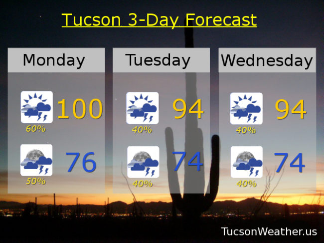
Lots of moisture with us and a low pressure trough approacheth. That should act as a trigger for rounds of storms starting as early as 11:00 this morning. Thunderstorms likely today, hopefully a few near you, with a high near 100.
Off and on storms are likely to continue through the overnight hours with a low in the mid 70s.
Low pressure trough still with us for a 40% chance for storms Tuesday and Tuesday night. High in the mid 90s.
A possible disturbance in the force riding northward out of Mexico Wednesday should provide a focus for more storms to form Wednesday and Wednesday night. High in the mid 90s.
“Things” calming down a bit Thursday but still a 20% to 30% chance for storms afternoon and evening mid 90s. 20% chance Friday upper 90s. Just a 10% chance Saturday mid 90s. 20% Sunday mid 90s. We do need the rain! Viva Monsoon 2018!!!