A couple of storms missing us just to the north will keep us breezy off and on this week and cool us off from our 90s for highs weekend. The first storm moves from central California to near Las Vegas by this afternoon. What happens in Vegas doesn’t stay in Vegas. The near enough proximity of the storm will kick up our breezes. Enough wind today for a RED FLAG WARNING. Display those red flags proudly but be careful setting stuff on fire. Cooler but not as windy tomorrow and then a second storm drops from Oregon into Utah Wednesday kicking up the wind once again. This storm will linger in the area as it slides slowly to our northeast. Could see a slight chance for a shower or storm on Thursday. Temperatures return to average for this time of year by the weekend. Enjoy!
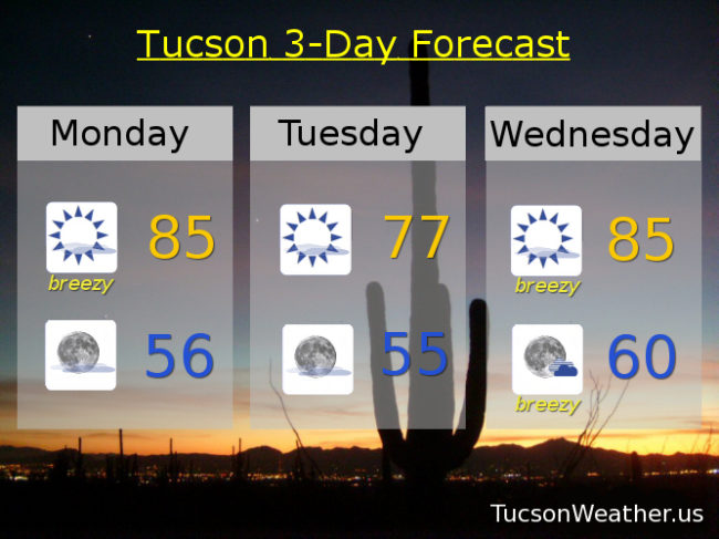
Sunny and breezy today with a SW wind 20-25 mph gusting to near 40 and a high in the mid 80s.
Clear tonight with winds relaxing overnight and a low in the mid 50s.
Sunny tomorrow with W wind 10-15 mph and a high in the upper 70s.
Breezy Wednesday with SW winds gusting over 30 and a high in the mid 80s. Slight chance for a shower or storm Thursday with a high in the mid 80s. Sunny Friday mid 80s. Low 90s Saturday. Mid 90s Sunday.