Here we go! A strong and unusually cold storm system for this time of year is on our doorstep. Actually it’s centered in Baja California and will be turning the corner and heading our way by tonight. Increasing chance for showers and thunderstorms as the system approacheth and moves through. Valley rain up to a quarter inch for most with some folks getting more. Hopefully near you! Still looking at 1-4 inches of snow above 7,000 feet. The storm exits stage east by Wednesday with a warming trend on its heals. Enjoy!
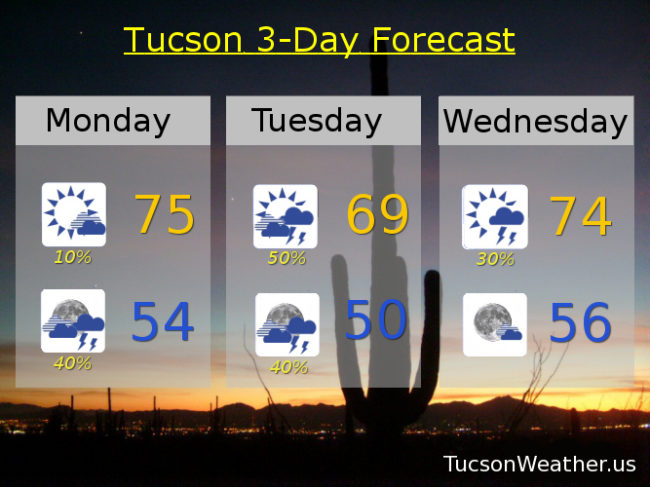
Partly cloudy today with a slight chance for a storm. S wind 5-15 mph and gusty with a high in the mid 70s.
Mostly cloudy tonight with a chance for showers and storms and a low in the mid 50s.
Partly sunny tomorrow with scattered showers and storms and a high near 70 maybe.
Lingering shower chances Wednesday morning with a high in the mid 70s. Sunny Thursday 85. Low 90s Friday. Mid 90s Saturday. Breezy low 90s Sunday.