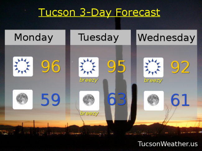
Yesterday we topped out at 90 which is well above the average of 83 for this time of year. Today we are forecasted to go from this morning’s low of 57 all the way up to a record shattering high of 96. A swing of almost 40 degrees! If it comes true that will easily top today’s record of 94 set in 1933. Tomorrow’s record high of 94 is also in jeopardy. High pressure should continue to weaken through the week with slowly falling temperatures. Winds picking up from the east tomorrow should be with us into early Wednesday before relaxing. No rain in sight. Don’t be mad at me, I’m just the messenger!
Sunny today with a new record high of 96.
Clear tonight with a low in the upper 50s.
Sunny and breezy tomorrow with east winds 15-25 mph gusting over 30 and a new record high of 95. Breezy Wednesday morning with winds relaxing by afternoon and a high in the low 90s. Sunny low 90s Thursday. Upper 80s Friday, Saturday and Sunday.