Get your red hot cold fronts here! High pressure is out and a cold front approacheth as a system will be missing us to the north. Look for increasing high clouds and breezes today with the National Weather Service in Tucson issuing a RED FLAG WARNING from Noon until 6:00 p.m. for an elevated fire danger. Please for the love of all that is right and good if you smoke keep your butts in the car. Also be careful setting stuff on fire today. Cooler tomorrow into Monday behind the front and then a warming trend again next week. Interesting pattern setting up mid week with high pressure east and low pressure northwest we may pull some moisture north out of Mexico. Afternoon storms next week? Maybe. Best chance would be mountains and east but it bears watching. Stay tuned!
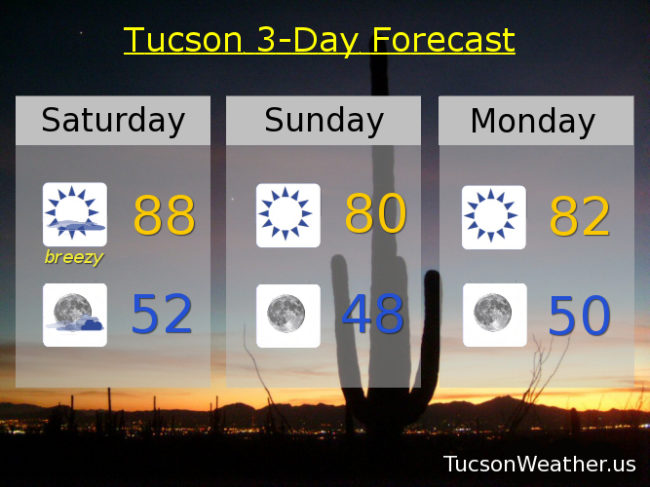
A mix of high clouds and sun today for possible sunrise and sunset enhancement. Breezy with west winds 15-20 mph this afternoon gusting to near 30 and a high in the upper 80s.
Partly cloudy tonight with west winds lingering 5-15 mph and a low in the low 50s.
Sunny and cooler tomorrow with northwest winds 5-15 mph and gusty and a high near 80.
Sunny Monday low 80s. Sunny Tuesday upper 80s. Low 90s Wednesday and Thursday. Upper 80s Friday.