All systems go for a Winter storm to hit SE Arizona! Clouds should be on the increase later today as the system approacheth. The storm is expected to pull moisture northward from the Gulf of California with slight rain chances starting as early as tonight. The main event will be Sunday with a good chance for showers and maybe a thunderstorm as the low moves through along with a cold front in the afternoon. A WINTER WEATHER ADVISORY has been issued for 1 to 3 inches of snow between 5,000 and 6,000 feet, 4 to 8 inches above 6,500 feet and 8 to 10 inches is possible in some areas above 7,500 – 8,000 feet. Be advised. Winter weather is expected in the mountains. Valley locations can expect .10″ – .30″ of rain with higher amounts possible with a thunderstorm if that happens, hopefully near you. Good times! The storm exits stage east Monday morning leaving us with sunshine and seasonably cool temperatures for much of next week. We are watching another storm that may arrive in time for Christmas weekend. Stay tuned!
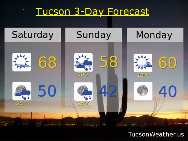
Increasing clouds today with a high in the upper 60s.
A 20% chance for rain showers tonight with a low near 50.
A 50% chance for showers tomorrow with a thunderstorm possible and a high near 58.
Decreasing clouds with a slight chance for a morning shower Monday and a high near 60. Sunny mid 60s Tuesday. Near 70ish Wednesday. Low 60s Thursday. Upper 50s Friday.