“Things” are fixin’ to get interestinger! A series of storms heading our way. Each colder than the one before. Rain and mountain snows just in time for Christmas and will continue into the new decade. But first…
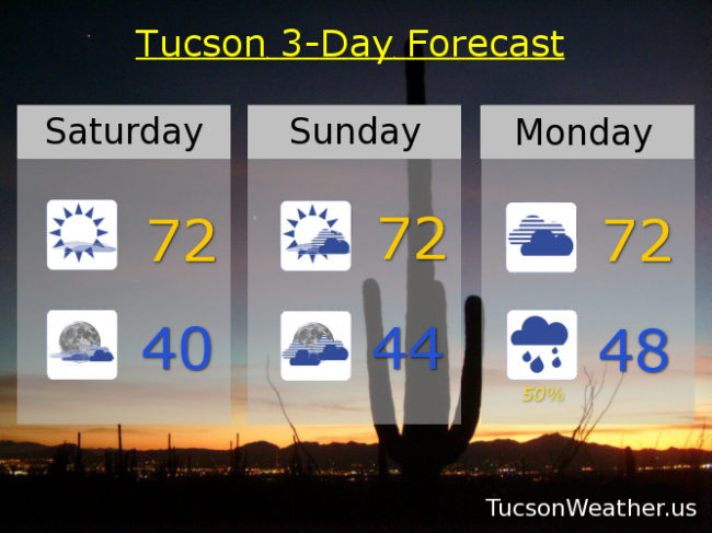
A ridge of high pressure will bring a warm up this weekend even as the clouds increase as our first storm approacheth. Mostly sunny today low 70s. Partly sunny tomorrow low 70s. Cloudy Monday low 70s.
The rain should commence Monday night with rain likely Tuesday and a high in the upper 50s. Snow levels dropping to around 6,000 feet with a few to 8 inches of snow for a White Christmas in Summerhaven.
A bit of a break Christmas Day but still a slight chance for showers and a high in the upper 50s.
Storm number 2 will bring us an increasing chance for showers Thursday and Friday with snow levels dropping to near 5,000 feetish perhaps. Thursday’s high near 60ish and Friday’s high in the mid to upper 50s.
Storm #3 is beyond the 7 day forecast, but it looks colder and stronger. Right now it appears snow levels may crash down to 4,000 feet. It’s a ways away, so a lot to sort out as we get closer. Stay tuned!