The HARD FREEZE WARNING that is set to expire at 9:00 this morning is coming true with a low so far at the airport of 29 degrees. My plants are inside from deck watching TV with me this morning. (just kidding. I don’t have the TV on…) It’ll be another chilly day (mmm chili) with a FREEZE WARNING still in place for tonight from midnight until 9:00 a.m. Sunday. Be warned. It’s gonna be freezing! All eyes are on our next storm and the computer models are starting to agree. Good chance for rain and mountain snow New Year’s Eve and New Year’s Morning! The big question is how low will the snow level go? The National Weather Service is likely to issue Winter highlights, as they call them. That just means we are likely to see a Winter Storm Watch above say 5,000 feet and maybe a Winter Weather Advisory above maybe 3,500 feet. You’ll know when it’s official because I’ll put those in ALL CAPS. Anyway, we could see snow showers in the Metro. Not expecting major accumulations in town or anything, but it could actually snow! Stay tuned and stuff!
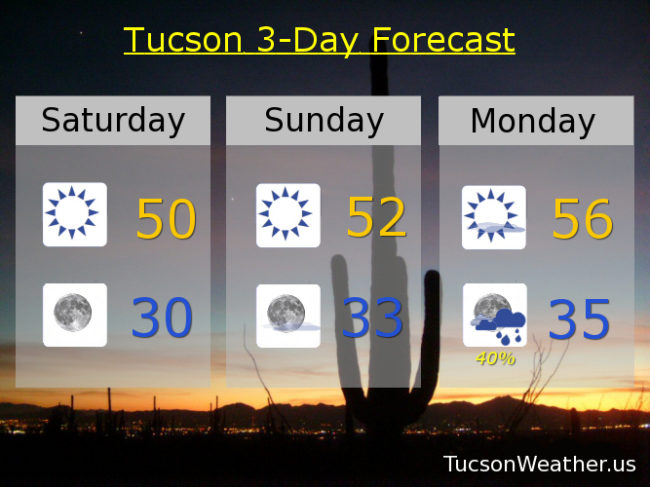
Sunny today with a high near 50ish. Mostly clear skies tonight with a low near 30. Sunny low 50s tomorrow. Mostly sunny Monday mid 50s. 40% chance for showers New Year’s Eve mid 30s. 20% chance New Year’s Day upper 40s. Sunny Wednesday low 50s. Low 60s Thursday. Upper 60s Friday. Enjoy!