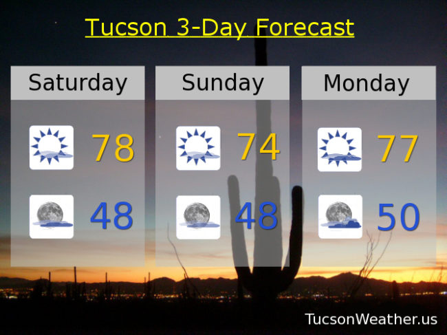
More high cloudiness today for possible sunrise and sunset enhancement as a system moves out of the Great Basin to the Four Corners. No threat of rain or mountain snow this far south and we’ll stay on the warm side. Upper 70s today. Mid 70s tomorrow. Upper 70s Monday.
By Monday night into Tuesday we’ll see those clouds start to thicken as another, stronger, storm heads our direction. Isolated showers possible Tuesday with the main event Tuesday night into Wednesday. Valley locations still looking at up to a half inch of rain from this storm. Snow levels dropping to around 5,000 – 6,000 feet. Cooler temperatures too. Isolated showers Tuesday mid 70s. Scattered showers Tuesday night into Wednesday morning becoming isolated Wednesday low 60s.
Sunshine returns Thursday and Friday with highs in the mid 60s to near 70 respectively. We’ll keep you posted as we go.