We hit 104 yesterday to break the record of 102 set in 1947. A storm approacheth as we are set to flip the weather script. MUCH cooler with a chance for showers and thunderstorms by Monday and especially Tuesday. Windy today and tomorrow in the transition. So much so that the National Weather Service has issued a WIND ADVISORY, so be advised, it’s going to be windy and a RED FLAG WARNING. Both are in effect from 10:00 this morning until 7:00 tonight. Please, for the love of all that is right and good, if you smoke keep your butt in the car. Also be careful setting stuff on fire or shooting exploding targets in the desert. The storm moves through Tuesday with our best chance for storms. Temperatures swinging from 16 degrees above average yesterday to 16 degrees below average Tuesday. A warming trend starts mid next week. Enjoy!
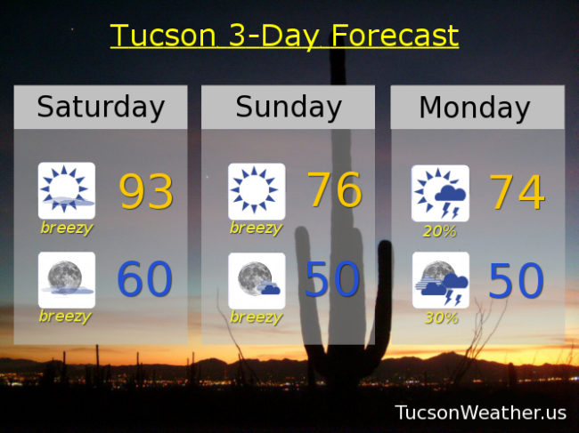
Mostly sunny and breezy today with S winds 20-25 mph gusting over 35 and a high in the low 90s.
Mostly clear tonight and breezy with S winds 15-20 mph relaxing after midnight and a low near 60.
Sunny and breezy tomorrow with S winds 15-25 mph gusting to near 35 and a high in the mid 70s. A slight chance for showers and storms Monday with a high in the mid 70s. Scattered showers and storms Tuesday low 70s. Mostly sunny Wednesday upper 70s. Upper 80s Thursday. Low 90s Friday.