There’s a lot of wind in this forecast as a strong system to our north approacheth from the Pacific Northwest. So much so that the National Weather Service has issued a RED FLAG WARNING starting at Noon today until 7:00 tonight. Not quite as windy tomorrow but a FIRE WEATHER WATCH has been issued from Noon tomorrow until 7:00 p.m. Please be careful setting stuff on fire lest you burn it all down! By Tuesday a secondary low travels further south around the backside of the first low. Looks like we might get into a chance for thunderstorms and/or showers Tuesday night situation! Maybe even a little snow above 6,500 feet!!! Turning much cooler with highs Wednesday and Thursday in the 70s. Looks like April will end with no rain for the month. Zero. Zip. Nada. May may be a different story!
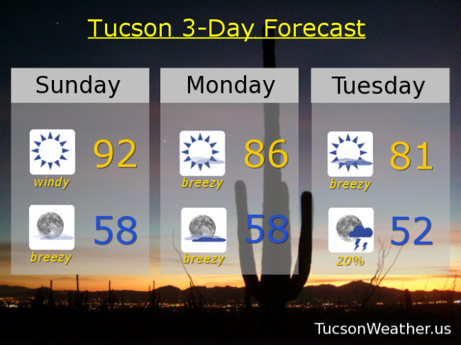
Sunny and windy today with areas of blowing dust and human misery. Winds becoming SW this afternoon 15-25 mph gusting to near 40 and a high in the low 90s.
Breezy tonight with SW winds 10-20 mph gusting to near 30 relaxing after midnight and a low in the upper 50s.
Sunny and breezy tomorrow with WSW winds 10-20 mph gusting to near 30 and a high in the mid 80s.
Partly sunny and breezy Tuesday with SW winds 15-25 mph gusting to near 35 and a high in the low 80s.
Chance for thunderstorms Tuesday evening and a chance for showers overnight with a low in the low 50s.
Mostly sunny Wednesday 75ish. Upper 70s Thursday. Upper 80s Friday. Mid 90s Saturday.