Run to the hills! You know. Because it’s cooler up there. They don’t call it Summerhaven for nothin’! High pressure is large and in charge and bringin’ the heat. EXCESSIVE HEAT WARNING from 10:00 this morning until tomorrow night at 8:00. Be warned, the heat will be excessive. Please make sure you stay hydrated lest you burst into flames. Never leave living things unattended in the car (oven) and walking the dog on hot asphalt is just cruel.
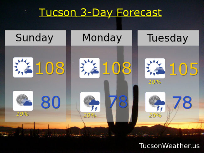
Today’s expected high of 108 would tie the record last set in 2009. Enough moisture around for a chance of an isolated storm this evening! Hopefully one near you, but it’s just a slight chance with a low tomorrow morning near 80.
Tomorrow’s record high is 109. We’ll be close! with an expected high of 108. Again, enough moisture trapped under the high for a 20% chance of storms tomorrow evening and a low in the upper 70s.
Our fortunes begin to reverse themselves as the high moves to the north. A tropical system near Baja California may even get into the act! Slight chance for a storm Tuesday afternoon with a high near 105. 20% chance Tuesday night upper 80s. Slight chance for a storm Wednesday 102. Wednesday night looks very promising with a 40% chance for storms mid 70s. 10%/30% Thursday 99ish. 20%/50% Friday 98. 30% Saturday mid 90s. Be cool!