The showers and thunderstorms have already begun! Rain overnight dropped just .02″ at the airport, but central and east Tucson picking up more than that with snow falling in the Catalinas and Rincons above 6,500 feet. A WINTER WEATHER ADVISORY remains in effect for the local mountains until 11:00 tonight, so be advised, there will be winter weather in the local mountains! Meanwhile back in the lowlands, look for periods of rain with a few thunderstorms today. Some valley locations could pick up around a half inch of rain. The high of 58ish should be realized later this morning before falling this afternoon as a cold front moves through. Snow levels dropping as low as 5,000 feet as possible periods of thundersnow pulls colder air from the upper atmosphere! As the low rolls through tonight and pulls away tomorrow our rain chances begin to fall with just a slight chance of a lingering shower tomorrow morning. It will remain on the cool side the next couple of days before warming to near 70 by Wednesday. Then our eyes turn to another storm expected to head our way by late into the week and the weekend. This storm will be colder, but it’s still uncertain how much rain and mountain snow it will bring. Stay tuned!
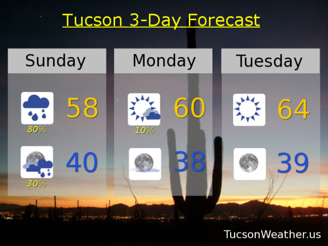
Periods of rain and a few thunderstorms today with a high near 58.
Scattered showers possible tonight with a low near 40.
A slight chance of a lingering shower tomorrow morning otherwise clearing skies with a high near 60.
Sunny Tuesday mid 60s. Near 70 Wednesday. Upper 50s Thursday. Mid 50s Friday. A chance for rain Saturday low 60s.