Our Tuesday night/Wednesday storm is coming into focus as we get closer. Looks like a tenth to a quarter inch of rain for valley locations around the metro with two to five inces of snow in the mountains. Snow levels starting out around 6,500 feet crashing to 3,500 feet by Wednesday morning.
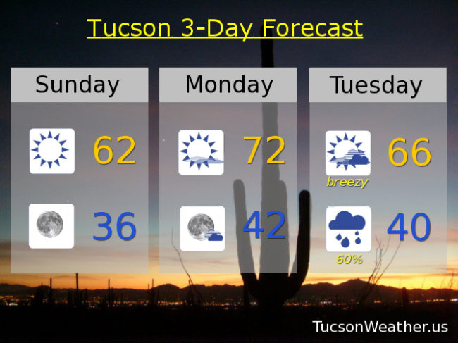
Right now we are between systems and that means sunshine and warming temperatures. A few degrees warmer than yesterday today with a high in the low 60s. Low tonight in the mid 30s. A degree or two above average for this time of year tomorrow with a high in the low 70s.
Breezy with increasing clouds Tuesday as the storm approacheth with a high in the mid 60s. Showers likely Tuesday night with a low near 40. Scattered showers mainly in the morning Wednesday with a high in the mid 50s.
Sunny and warming up Thursday with a high in the upper 60s. Low 70s Friday and Saturday. Enjoy!