Get ready for an interesting 24-36 hours. Looks like an upper level low will be moving across the area today into tomorrow morning. That should lead to pretty widespread heavy rainfall. Worst case scenario we will have widespread flooding to go with it. Confidence is pretty high that there will be some flooding rain in the area. As a result of the clouds and rain potential we could see a high only in the upper 80s to near 90. If we stay below 90 for a high today it will be the first July day below 90 since 2010. Let’s make it happen! Drying out quite a bit by Tuesday with less storm activity and warmer temperatures into next weekend. Looks like the wetter weather returns next week! Best Monsoon Evah!
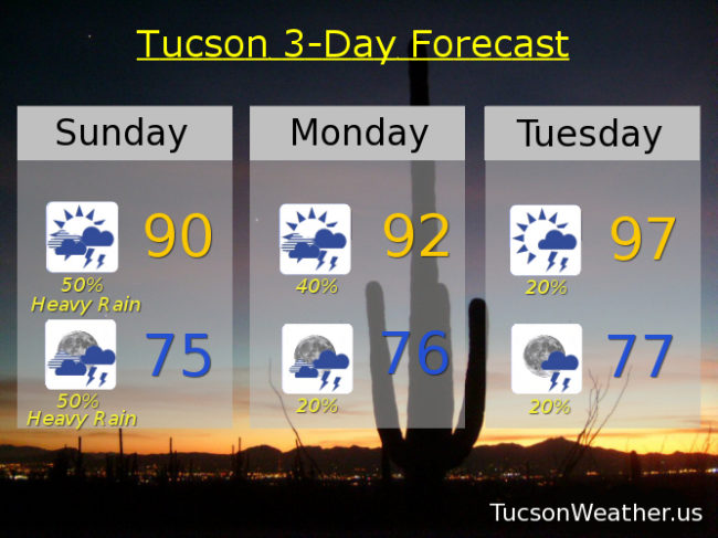
Mostly cloudy today with showers and storms likely, some with heavy rain, and a high near 90.
Mostly cloudy tonight with showers and storms likely, some with heavy rain, and a low in the mid 70s.
Partly sunny tomorrow with scattered showers and storms and a high in the low 90s.
Partly cloudy Tuesday through Saturday with isolated storms and highs in the upper 90s.