Well that was fun! Record rainfall yesterday for the second day in a row means we are off to a record start to Monsoon 2018! We ended up with .74″ at the airport yesterday with many locations around town picking up more and some much more. Thanx Bud! Also, yesterday’s high of 81 was the coolest high ever for a June 16th. Yesterday’s upper level low that helped turn all that moisture into showers and storms has moved off to the east and we are left with a drying and warming trend this week. Getting back to hot by the end of the week.
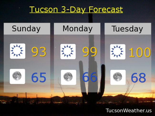
Sunny today with SE breeze becoming SWesterly this afternoon and a high in the low 90s.
Clear skies tonight and refreshingly cool tomorrow morning with a low in the mid 60s.
Upper 90s tomorrow. Near 100ish Tuesday. 101 Wednesday. 104 Thursday. 106 Friday. 105 Saturday. Enjoy!