Yesterday is what an average day for this time of year looks like. We started the day with a low of 56 (55 is average) and topped out in the afternoon at the average of 83. Pretty nice, huh?! (just a reminder, you can always go to www.tucsonweather.us and look up all the almanac’s for the past year and beyond) As we’ve been talking about for some time, it’s not going to last. High pressure re-exerting itself starting today should warm us quickly to near record highs Monday through Thursday. Then our high de-exerts itself somewhat for cooler weather by the end of the week, but warmer than we should be for late October. Still, even though the afternoons are toasty, the mornings remain quite nice. Enjoy!
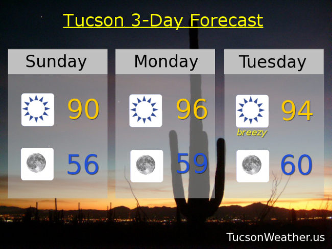
Sunny today with a high near 90.
Clear skies tonight with a low in the mid 50s.
Sunny tomorrow with a high near 96. The record is 94 set in 1933 so…
Sunny and breezy Tuesday with east winds 15-25 mph gusting over 30 and a high near 94. Shy of the record of 96. Wednesday’s record is 95, we should be around 93ish. Near 90 Thursday. Upper 80s Friday. Mid 80s Saturday.