Here comes the wind again. Bad news for the Sawmill Fire. Prayers for the firefighters that are now here from around the country to fight it. RED FLAG WARNINGS are up for today and tomorrow. Please for the love of all that is right and good, if you smoke keep your butt in the car! (or truck or SUV) A couple of systems moving by to the north will keep us windy. The second system will cool us off quite a bit Saturday with highs 10 degrees below average and lows in the 40s Sunday morning! Sunday looks amazing with a high in the low 80s. Then we start a warming trend next week. Stay tuned!
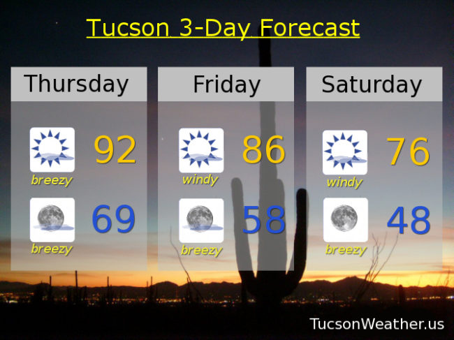
Mostly sunny with W winds 15-25 mph gusting over 35 and a high in the low 90s.
Mostly clear and breezy tonight with WSW 10-20 mph gusting to near 30 becoming southerly and relaxing some after midnight and a low in the upper 60s.
Mostly sunny and windy tomorrow with WSW winds 20-30 gusting over 40 and a high in the mid 80s.
Sunny and breezy Saturday with NW winds 10-20 gusting to near 30 and a high in the mid 70s. Sunny Sunday low 80s. Near 90 Monday. Low 90s Tuesday and Wednesday.