Happy Friday Eve! It makes the weekend seem closer…
There’s a storm brewin’! (coffee maybe?), and it’s headed our way. Prime time looks to be Saturday morning. Wind, rain, and even some thunderstorms possible with this one. Suspected rainfall amounts have been adjusted higher by the robots (computer models) once again! Valley locations could see a quarter to three quarters of an inch of rain with isolated amounts over an inch. Bring it! The mountains should get more, but we are talking rain and not snow. Could be fun! Here’s the best guesstimation of the future (echo; future future future)
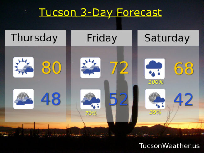
Increasing clouds and breezy today. High near 80ish! Mostly cloudy tonight upper 40s. Mostly cloudy and windy tomorrow with ESE winds 15-25 mph gusting over 35 and a high in the low 70s. The rain chances commence tomorrow night with the best chances toward morning into Saturday. 100% chance for rain Saturday with a few thunderstorms thrown in for good measure and a high in the upper 60s. Lingering showers Saturday night with clear skies by Sunday. Sunny Sunday low 60s. Upper 60s Monday. Near 70ish Tuesday. Low 70s Wednesday. Enjoy!