The HARD FREEZE WARNING is fixin’ to end at 9:00 this morning and then we can start our warming trend. Mid 20s to start the day is rather brisk, so I imagine that you might welcome some sunshine and relative warmth. If you have snow on the ground it will be going from concrete this morning to mostly gone later today. The exception will be up in the mountains and down here in the shade 😎 Our next storm approacheth Saturday with increasing clouds and rain in here by Saturday night. Snow levels will start high and then fall to around 7,500 feet. As you can see this storm is quite a bit warmer than the last few. It has a lot of moisture to work with too. It could be a good soaking for us valley dwellers. Ski Valley on Mt. Lemmon might add quite a bit to their 40″ base! Storm moves along on Monday and we warm up again Tuesday and Wednesday. As I’ve been showing you on the last few livestreams at least one computer model is hinting that a couple more storms are likely heading our way as we head into mid January. Stay tuned!
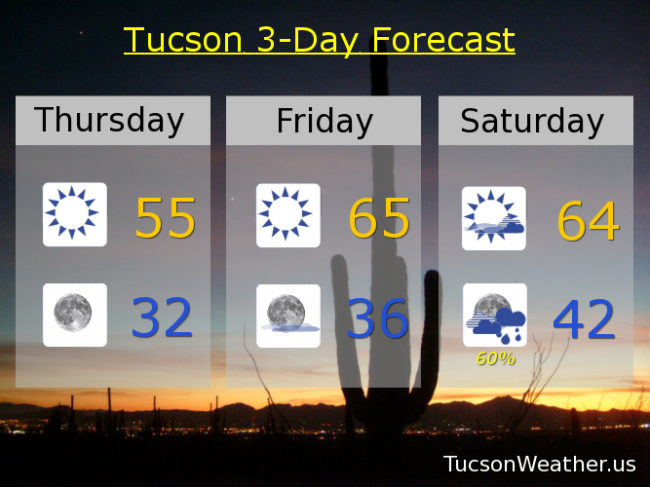
Sunny today with a high in the mid 50s. Clear skies at night near freezing. Mid 60s tomorrow. Partly sunny mid 60s Saturday. 60% chance for rain Saturday night low 40s. 70% Sunday mid 50s. 10% Monday low 60s. Mostly sunny Tuesday and Wednesday upper 60s to near 70ish! Enjoy!