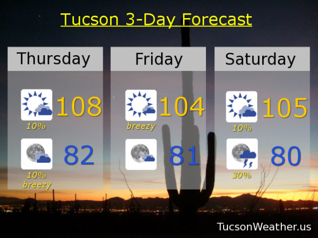
So you’re saying there’s a chance! Before we dive in to a busy forecast let’s start with yesterday. 103 for the third day in a row with a bit of an afternoon breeze. Those temperatures and wind speeds are on the way up along with storm chances. EXCESSIVE HEAT WARNING today from 10:00 a.m. until 9:00 p.m. so be warned, the heat will be excessive. Make sure you stay hydrated lest you burst into flames! Today’s expected of high of 108 is getting too close for comfort to the record of 111. Also. A slight chance for an isolated storm or two this afternoon and evening. It’s still too dry at the surface so IF we see a storm it’s likely to create some strong gusty winds and maybe mostly dry lightning.
Any storms that form will die with the setting sun and the east winds will start to increase overnight keeping our morning low not so low in the low 80s. East winds could gust to 40 mph and so we have a WIND ADVISORY from 3:00 a.m. until 3:00 p.m.. Be advised, it’s gonna be windy.
Mostly sunny and windy tomorrow like I just mentioned with a high near 104ish.
Moisture on the increase this weekend into next week. Storm chances on the rise! Singing in the rain and dancing in the streets! 10% chance for storms Saturday 105. 30% chance for storms Saturday night! 20% chance for storms Sunday 102 and 40% Sunday night. 40% chance for storms Monday 100. 40% chance for storms Tuesday upper 90s. 40% chance for storms Wednesday mid 90s.