It’s Friday Eve! Makes the weekend seem closer 🙂
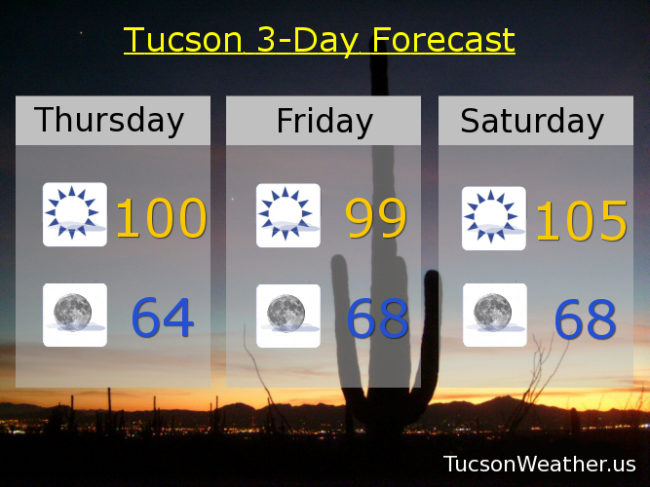
Yesterday’s expected high was 100. In the words of Maxwell Smart, we “missed it by that much”. We did hit 99 which was his beautiful agent girlfriend/wife, so there’s that. Average for this time of year is 97, so not far off. We’ll make another run at 100 today with some SW breezes in the afternoon and a few clouds perhaps for sunset enhancement, but mostly it will be sunshine and warm.
Clear skies tonight with a low in the mid 60s. So nice in the mornings.
Sunny tomorrow 99ish. High pressure building in for the weekend and hot. 105 Saturday. A record tying 107 Sunday (if it comes exactly true). 105 Monday. 103 Tuesday.
“Things” could get interesting by Wednesday. As high pressure moves into New Mexico there will be an increase in moisture in our neck of the woods (er, Saguaro forest?). The computer models are hinting at a disturbance in the force riding northward out of Mexico on the western edge of the high that might trigger thunderstorms! Don’t get too excited yet. It’s still pretty far out in forecast terms and the National Weather Service hasn’t put the possibility in it’s official forecast yet. Just something to keep an eye on and of course we’ll keep you posted here. I’ve been hearing Cicadas since last week! Maybe it means something. Stay tuned and be cool.