The winds of change and a taste of Fall blowing in with a cool front. A couple of systems to our north will bring snow to the northern Rockies. We’ll get some cooler air with refreshingly cool mornings coming up in the upper 60s! Some moisture returns starting Sunday for slight storm chances into next week.
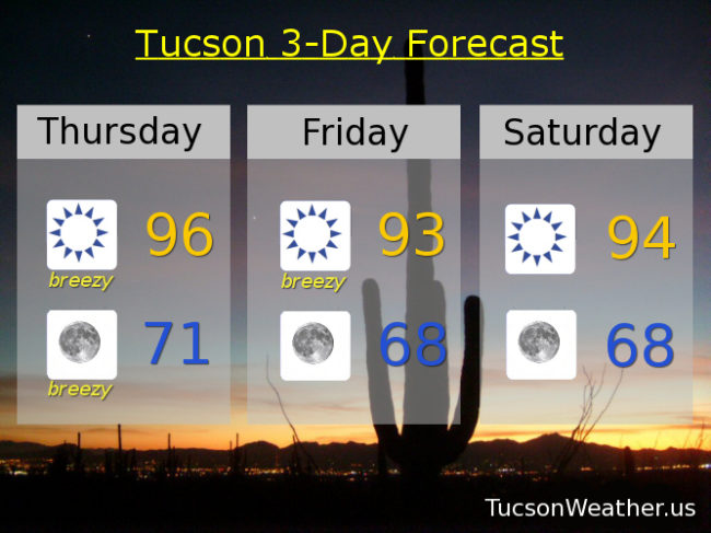
Sunny today becoming breezy this afternoon with SW winds 15-25 mph gusting over 30 and a high in the mid 90s.
Breezy tonight with winds relaxing after midnight. SW winds 5-15 mph gusting over 25 and a low in the low 70s.
Breezy Friday with SW winds 10-20 mph gusting over 25 and a high in the low 90s. Upper 60s to start the day Saturday with highs in the mid 90s. Upper 60s to start the day Sunday with a 10% chance of an afternoon storm and a high in the mid 90s. A 20% chance for afternoon and evening storms Monday, Tuesday and Wednesday with highs near 95, 94 and 92. Enjoy!